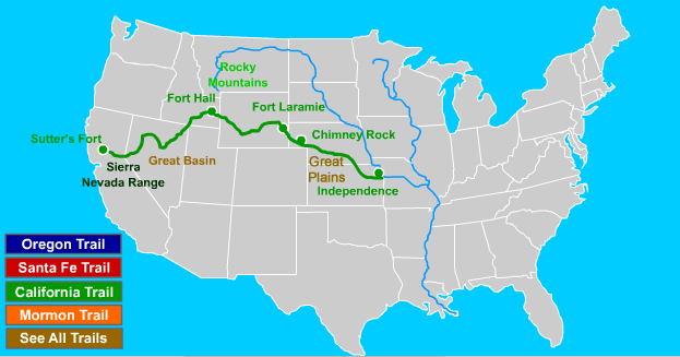
This is an interactive tour map of the California Trail that allows students to click on important points from Independence, Missouri, to Sutter's Fort, California.
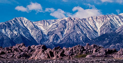
Sierra Nevada Mountains |
Fortune Seekers and 49ers
The California Trail was one of several major routes used by settlers during westward expansion. The trail itself followed the same path as the Oregon Trail until Fort Hall, Idaho, where it spiraled southwest along the Humboldt River through the Great Basin of Nevada, the Sierra Nevada Mountains of California, and finally to Sutter's Fort, (Sacramento) California.
Over 250,000 gold-seekers and farmers-to-be used the trail to seek fortune in the mines, or, to settle on farm homesteads from the late 1840's to the late 1860's. Like most of the overland migration trails, the California Trail was no longer used after the introduction of the railroads.
Next Stop: Independence
|
|
Advertisement

Remove ad