

Maps - Interactive
This section contains hundreds of interactive maps of the world, continents, nations, states and regions.

Interactive World Map and World Map Games
Description: This is an incredible map of the world that allows students to explore an interactive map of the world, or, play games testing their knowledge of the nations or waterways of the world. Works on all devices!
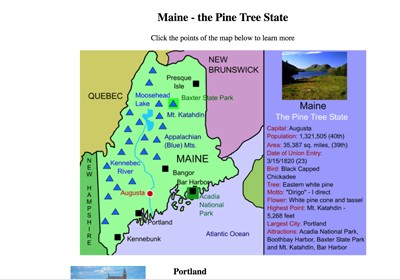
Maine Interactive Map
Description: This activity allows students to learn all about the landmarks, cities, waterways, and landforms of Maine, simply by clicking on its points. Use this map with the printable Maine scavenger hunt.
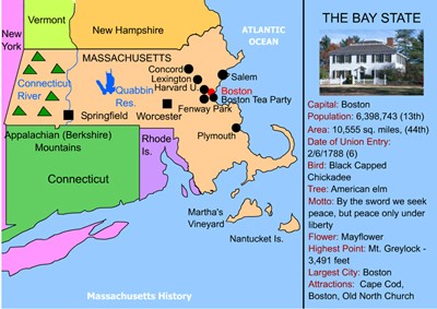
Massachusetts Interactive Map
Description: This map of Massachusetts allows students to click on any point to learn more about the location. Use this map with the Massachusetts Scavenger Hunt
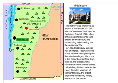
Vermont Interactive Map
Description: This resource allows students to learn all about the important cities, landforms, landmarks, and places of interest in Vermont, simply by clicking them on the map. Use this map with the Vermont Scavenger Hunt

New Hampshire Interactive Map
Description: This interactive map allows students to learn all about New Hampshire's cities, landforms, landmarks, and places of interest by simply clicking on the points of the map.

Connecticut Interactive Map
Description: This is a Connecticut interactive map. Students simply click a point on the map to learn about it. Use the printable scavenger hunt with this map.

Rhode Island Interactive Map
Description: This Rhode Island interactive map allows students to learn about important points within the state, simply by clicking. Use this map with the Rhode Island scavenger hunt.
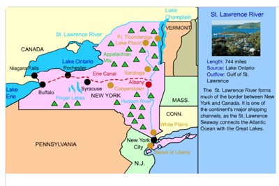
New York Interactive Map
Description: This interactive map allows students to learn all about New York's cities, landforms, landmarks, and places of interest by simply clicking on the points of the map. Use the New York scavenger hunt with this map.
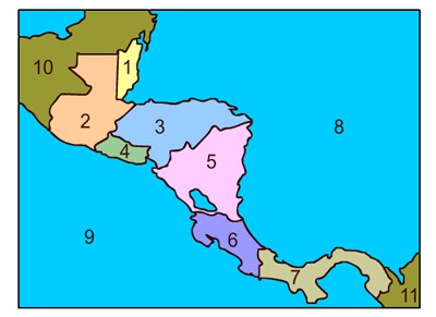
Central America Interactive Map
Description: This interactive map of Central America allows students to click on any of the Central American nations to access interactive maps. Includes interactive maps of Belize, Costa Rica, Honduras, Guatemala, El Salvador, Nicaragua, and Panama.
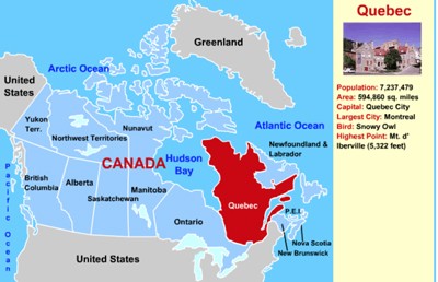
Canada Interactive Map
Description: This interactive map allows students to learn all about Canada's provinces by simply clicking on the points of the map.

France Interactive Map
Description: This interactive map allows students to learn all about France's cities, landforms, landmarks, and places of interest by simply clicking on the points of the map.
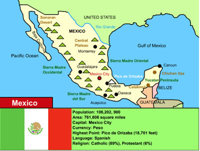
Mexico Interactive Map
Description: This is an interactive map of Mexico. Students simply click on the points of the map to learn all about Mexico.
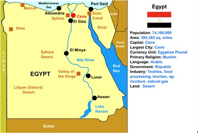
Egypt Interactive Map
Description: This is an interactive map of the Egypt. Students simply click on the points of the map to learn all about them.

Thailand Interactive Map
Description: This is an interactive map of the Thailand. Students simply click on the points of the map to learn all about them.
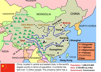
China Interactive Map
Description: This interactive map allows students to learn all about New China's cities, landforms, landmarks, and places of interest by simply clicking on the points of the map.
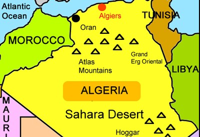
Algeria Interactive Map
Description: This is an interactive map of the Sahara Desert nation of Algeria. Students simply click on the points of the map to learn all about Algeria.

Pennsylvania Interactive Map
Description: This interactive map allows students to learn all about Pennsylvania's cities, landforms, landmarks, and places of interest by simply clicking on the points of the map.

Delaware Interactive Map
Description: This interactive map allows students to learn all about Delaware's cities, landforms, landmarks, and places of interest by simply clicking on the points of the map.
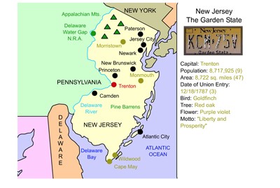
New Jersey Interactive Map
Description: This interactive map allows students to learn all about New Jersey's cities, landforms, landmarks, and places of interest by simply clicking on the points of the map.

Maryland Interactive Map
Description: This interactive map allows students to learn all about Maryland's cities, landforms, landmarks, and places of interest by simply clicking on the points of the map.
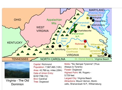
Virginia Interactive Map
Description: This interactive map allows students to learn all about Virginia's cities, landforms, landmarks, and places of interest by simply clicking on the points of the map.
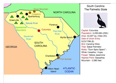
South Carolina Interactive Map
Description: This interactive map allows students to learn all about South Carolina's cities, landforms, landmarks, and places of interest by simply clicking on the points of the map.
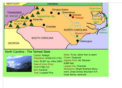
North Carolina interactive Map
Description: This interactive map allows students to learn all about North Carolina's cities, landforms, landmarks, and places of interest by simply clicking on the points of the map.
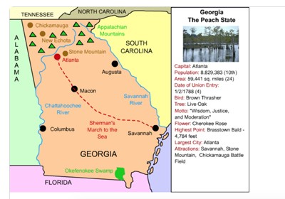
Georgia Interactive Map
Description: This interactive map allows students to learn all about Georgia's cities, landforms, landmarks, and places of interest by simply clicking on the points of the map.
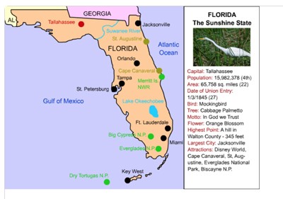
Florida Interactive Map
Description: This interactive map allows students to learn all about Florida's cities, landforms, landmarks, and places of interest by simply clicking on the points of the map.

North America Interactive Map
Description: Students can click on the nations of North America and learn about the population, area, rankings, and more of each!
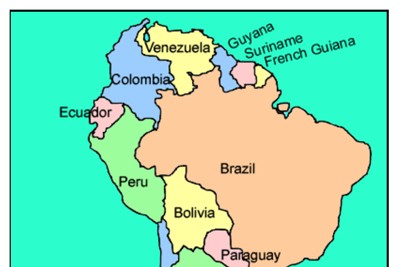
South America Interactive Map
Description: This interactive map allows students to click on any of the countries to read a short summary and to see basic statistics.
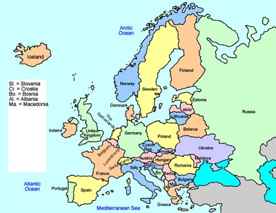
Europe Interactive Map
Description: This interactive map allows students to learn all about the european nations simply clicking on the points of the map.
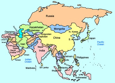
Asia Interactive Map
Description: This is an interactive map of Asia and its countries. Simply click on country in Asia to learn about its population, size, money, and more!
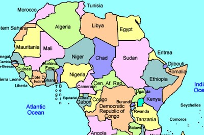
Africa Interactive Map
Description: This is an interactive map of the continent of Africa. Simply click on a country to see its statistics and basic information.

Australia and Oceania interactive Map
Description: This interactive map allows students to learn all about the history and features of Australia and Oceania. Simply click and learn.

Brazil Interactive Map
Description: This interactive map allows students to learn all about Brazil's cities, landforms, landmarks, and places of interest by simply clicking on the points of the map.
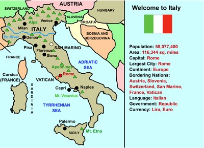
Italy Interactive Map
Description: This interactive map allows students to learn all about Italy's cities, landforms, landmarks, and places of interest by simply clicking on the points of the map.
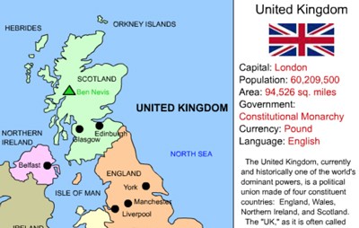
United Kingdom Interactive Map
Description: This interactive map allows students to learn all about the UK's cities, landforms, landmarks, and places of interest by simply clicking on the points of the map. Note - This is a flash activity that will not work on mobile devices.
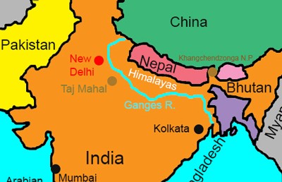
India Interactive Map
Description: This interactive map allows students to learn all about India's cities, landforms, landmarks, and places of interest by simply clicking on the points of the map.

Indonesia Interactive Map and Profile
Description: This is a beautiful interactive map of Indonesia. Students simply click on the points of the map to learn more.

Libya Interactive Map
Description: This is an interactive map of the Sahara Desert nation of Libya. Students simply click on the points of the map to learn all about Mali.

Angola Interactive Map
Description: This is an interactive map of Angola. Students simply click on the points of the map to learn all about Angola.

Morocco Interactive Map
Description: This is an interactive map of the Sahara Desert nation of Morocco. Students simply click on the points of the map to learn all about Morocco.

Venezuela Interactive Map and Interesting Facts - Online
Description: This beautiful interactive map allows students to click on any part of Venezuela to learn more about its cities, points of interest, and rivers. It also provides ten interesting facts about Venezuela as well as statistics and information about its flag. Perfect for country reports!

Alabama Interactive Map
Description: This interactive map allows students to learn all about Alabama''s cities, landforms, landmarks, and places of interest by simply clicking on the points of the map.

New England Interactive Map
Description: This interactive map allows students to learn all about New England's states, cities, landforms, landmarks, and places of interest by simply clicking on the points of the map.
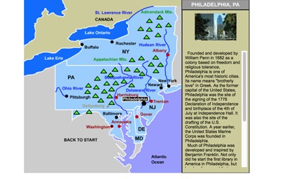
Mid-Atlantic States Interactive Map
Description: This interactive map allows students to learn all about the Mid-Atlantic states, cities, landforms, landmarks, and places of interest by simply clicking on the points of the map.
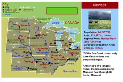
Midwestern States Interactive Map
Description: This interactive map allows students to learn all about the cities, landforms, landmarks, and places of interest of the midwestern states by simply clicking on the points of the map.
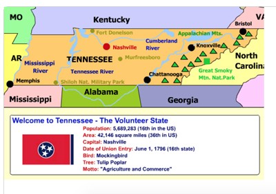
Tennessee Interactive Map
Description: This interactive map allows students to learn all about Tennessee's cities, landforms, landmarks, and places of interest by simply clicking on the points of the map.
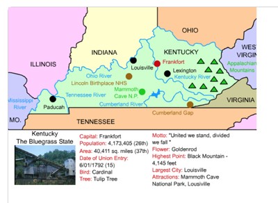
Kentucky Interactive Map
Description: This interactive map allows students to learn all about Kentucky's cities, landforms, landmarks, and places of interest by simply clicking on the points of the map.

Arkansas Interactive Map
Description: This interactive map allows students to learn all about Arkansas's cities, landforms, landmarks, and places of interest by simply clicking on the points of the map.

Southern States Interactive Map
Description: This interactive map allows students to learn all about the states, cities, landforms, landmarks, and places of interest in the American South by simply clicking on the points of the map.
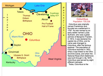
Ohio Interactive Map
Description: This interactive map allows students to learn all about Ohio's cities, landforms, landmarks, and places of interest by simply clicking on the points of the map.
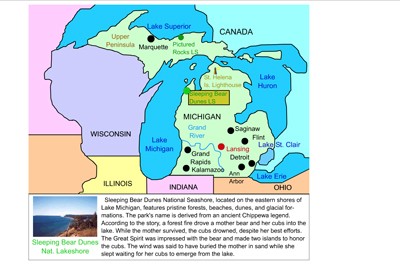
Michigan Interactive Map
Description: This interactive map allows students to learn all about Michigan's cities, landforms, landmarks, and places of interest by simply clicking on the points of the map.

Wisconsin Interactive Map
Description: This interactive map allows students to learn all about Wisconsin's cities, landforms, landmarks, and places of interest by simply clicking on the points of the map.
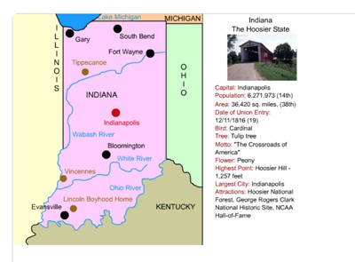
Indiana Interactive Map
Description: This interactive map allows students to learn all about Indiana's cities, landforms, landmarks, and places of interest by simply clicking on the points of the map.
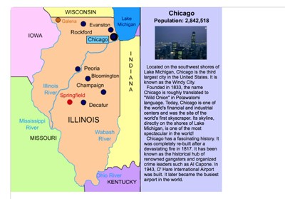
Illinois Interactive Map
Description: This interactive map allows students to learn all about Illinois's cities, landforms, landmarks, and places of interest by simply clicking on the points of the map.

Missouri Interactive Map
Description: This interactive map allows students to learn all about Missouri's cities, landforms, landmarks, and places of interest by simply clicking on the points of the map.
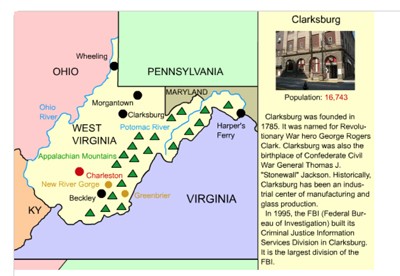
West Virginia Interactive Map
Description: This interactive map allows students to learn all about West Virginia's cities, landforms, landmarks, and places of interest by simply clicking on the points of the map.
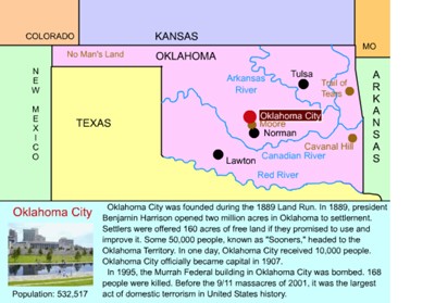
Oklahoma Interactive Map
Description: This interactive map allows students to learn all about Oklahoma's cities, landforms, landmarks, and places of interest by simply clicking on the points of the map.

Kansas Interactive Map
Description: This interactive map allows students to learn all about Kansas's cities, landforms, landmarks, and places of interest by simply clicking on the points of the map.

Nebraska Interactive Map
Description: This interactive map allows students to learn all about Nebraska's cities, landforms, landmarks, and places of interest by simply clicking on the points of the map.

Iowa Interactive Map
Description: This interactive map allows students to learn all about Iowa's cities, landforms, landmarks, and places of interest by simply clicking on the points of the map.
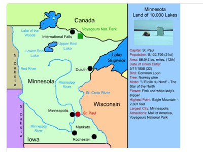
Minnesota Interactive Map
Description: This interactive map allows students to learn all about Minnesota's cities, landforms, landmarks, and places of interest by simply clicking on the points of the map.

South Dakota Interactive Map
Description: This interactive map allows students to learn all about South Dakota's cities, landforms, landmarks, and places of interest by simply clicking on the points of the map.

North Dakota Interactive Map
Description: This interactive map allows students to learn all about North Dakota's cities, landforms, landmarks, and places of interest by simply clicking on the points of the map.

Montana Interactive Map
Description: This interactive map allows students to learn all about Montana's cities, landforms, landmarks, and places of interest by simply clicking on the points of the map.

Wyoming Interactive Map
Description: This interactive map allows students to learn all about Wyoming's cities, landforms, landmarks, and places of interest by simply clicking on the points of the map.

Idaho Interactive Map
Description: This interactive map allows students to learn all about Idaho's cities, landforms, landmarks, and places of interest by simply clicking on the points of the map.
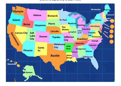
United States Capital Cities Interactive Map
Description: This awesome interactive map allows students to click on any of America's capital cities to learn about their histories and points of interest.
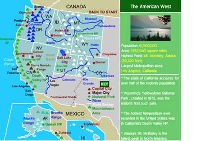
Western States Interactive Map
Description: This interactive map allows students to learn all about the states, cities, landforms, landmarks, and places of interest in the American West, by simply clicking on the points of the map.
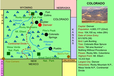
Colorado Interactive Map and History
Description: This interactive map allows students to learn all about Colorado's cities, landforms, landmarks, and places of interest by simply clicking on the points of the map. State history timeline is also included.

Arizona Interactive Map
Description: This interactive map allows students to learn all about Arizona's cities, landforms, landmarks, and places of interest by simply clicking on the points of the map.

Nevada Interactive Map
Description: This interactive map allows students to learn all about Nevada's cities, landforms, landmarks, and places of interest by simply clicking on the points of the map.

California Interactive Map
Description: This interactive map allows students to learn all about California's cities, landforms, landmarks, and places of interest by simply clicking on the points of the map.
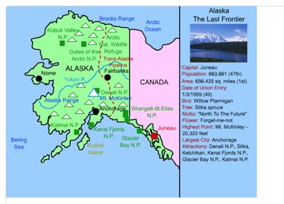
Alaska Interactive Map
Description: This interactive map allows students to learn all about Alaska's cities, landforms, landmarks, and places of interest by simply clicking on the points of the map.

Hawaii Interactive Map
Description: This interactive map allows students to learn all about Hawaii's cities, landforms, landmarks, and places of interest by simply clicking on the points of the map.

Japan Interactive Map
Description: This is an interactive map of Japan. Students simply click on the points of the map to learn all about Japan.
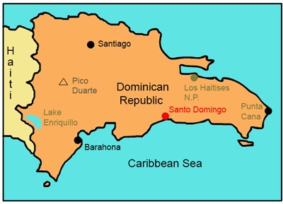
Dominican Republic Interactive Map and Interesting Facts
Description: This is an interactive map of the Dominican Republic. Students simply click on the points of the map to learn all about it. It also includes important statistics, interesting facts, and information about the flag.
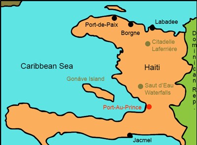
Haiti Interactive Map and Interesting Facts
Description: This is an interactive map of the Haiti. Students simply click on the points of the map to learn all about it. It also includes important statistics, interesting facts, and information about the flag.

Kenya Interactive Map
Description: This interactive map allows students to learn all about Kenya's cities, landforms, landmarks, and places of interest by simply clicking on the points of the map.

Mali Interactive Map
Description: This is an interactive map of the Sahara Desert nation of Mali. Students simply click on the points of the map to learn all about Mali.

Washington D.C. Interactive Map
Description: This interactive map allows students to learn all about Washington's cities attractions, monuments, and places of interest by simply clicking on the points of the map.

Washington D.C. Metro Area Interactive Map
Description: This interactive map allows students to learn all about the history of the "DMV's" cities and places of interest. Northern Virginia and Maryland.

Mississippi Interactive Map
Description: This interactive map allows students to learn all about Mississippi's cities, landforms, landmarks, and places of interest by simply clicking on the points of the map.
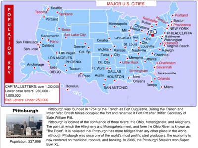
United States Cities Interactive Map
Description: This interactive map allows students to click on over 50 American cities to learn about their histories and attractions. This is a fantastic tool for state or city research projects.
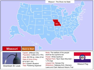
United States Interactive Map
Description: Click on any state in the United States map to learn about important facts such as symbols, area, population, motto, and more.
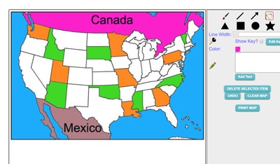
Maptivation - Online Map Making
Description: This is an awesome resource that allows kids to label and color maps online. States, regions, nations, and more are available. It can be a bit "glitchy" at time as the kids say, but by and large it is perfect for online coloring, printing, and labeling maps. Fill tool problem is now FIXED.
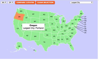
United States Symbols and Statistics Interactive Map
Description: This awesome interactive map allows students to learn all about state symbols such as bird, tree, flower, motto, nickname or state statistics such as area, population, highest point, electoral value and more, simply by selecting the information of interest and then mousing over the states. Incredible research tool. Enjoy the scavenger hunts that go with this map.

Louisiana Interactive Map
Description: This interactive map allows students to learn all about Mississippi's cities, landforms, landmarks, and places of interest by simply clicking on the points of the map.

Cuba Interactive Map and Interesting Facts
Description: This interactive map allows students to click on the points of the map to learn about them. It also provides interesting facts and historical information.

Tunisia Interactive Map
Description: This is an interactive map of the Sahara Desert nation of Tunisia. Students simply click on the points of the map to learn all about Tunisia.
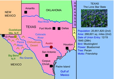
Texas Interactive Map
Description: This interactive map allows students to learn all about Texas's cities, landforms, landmarks, and places of interest by simply clicking on the points of the map.
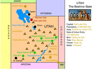
Utah Interactive Map
Description: This interactive map allows students to learn all about Utah's cities, landforms, landmarks, and places of interest by simply clicking on the points of the map.

Washington Interactive Map
Description: This interactive map allows students to learn all about Washington's cities, landforms, landmarks, and places of interest by simply clicking on the points of the map.

Colombia Interactive Map and Interesting Facts
Description: This interactive map allows students to click on the points of the map to learn about them. It also provides interesting facts and historical information.
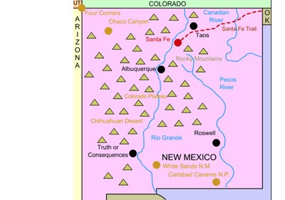
New Mexico Interactive Map and History
Description: This interactive map allows students to learn all about New Mexico's cities, landforms, landmarks, and places of interest by simply clicking on the points of the map.

Tanzania Interactive Map and Interesting Facts
Description: This interactive map allows students to click on the points of interest in Tanzania to learn detailed information. The page also includes the nation's flag and meaning, and ten interesting facts.

Spain Interactive Map
Description: This is an interactive map of Spain. Students simply click the points on the map to learn more.

Argentina Interactive Map and Interesting Facts
Description: This interactive map allows students to click on the points of interest in Argentina to learn detailed information. The page also includes the nation's flag and meaning, and ten interesting facts.

Labrador and Newfoundland Interactive Map and Interesting Facts
Description: This interactive map of Labrador and Newfoundland allows students to click on points of interest to learn about them. In addition, the page features interesting facts about the province, statistics, and the symbolism of the flag.
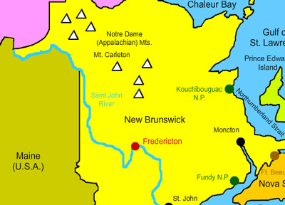
New Brunswick Interactive Map and Interesting Facts
Description: This interactive map of New Brunswick allows students to click on points of interest to learn about them. In addition, the page features interesting facts about the province, statistics, and the symbolism of the flag.
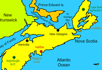
Nova Scotia Interactive Map and Interesting Facts
Description: This interactive map of Nova Scotia allows students to click on points of interest to learn about them. In addition, the page features interesting facts about the province, statistics, and the symbolism of the flag.

Prince Edward Island Interactive Map and Interesting Facts
Description: This interactive map of Prince Edward Island allows students to click on points of interest to learn about them. In addition, the page features interesting facts about the province, statistics, and the symbolism of the flag.
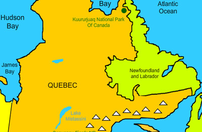
Quebec Interactive Map and Interesting Facts
Description: This interactive map of Quebec allows students to click on points of interest to learn about them. In addition, the page features interesting facts about the province, statistics, and the symbolism of the flag.
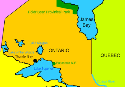
Ontario Interactive Map and Interesting Facts
Description: This interactive map of Ontario allows students to click on points of interest to learn about them. In addition, the page features interesting facts about the province, statistics, and the symbolism of the flag.

Manitoba Interactive Map and Interesting Facts
Description: This interactive map of Manitoba allows students to click on points of interest to learn about them. In addition, the page features interesting facts about the province, statistics, and the symbolism of the flag.

Saskatchewan Interactive Map and Interesting Facts
Description: This interactive map of Saskatchewan allows students to click on points of interest to learn about them. In addition, the page features interesting facts about the province, statistics, and the symbolism of the the flag.

Alberta Interactive Map and Interesting Facts
Description: This interactive map of Alberta allows students to click on points of interest to learn about them. In addition, the page features interesting facts about the province, statistics, and the symbolism of the flag.
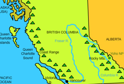
British Columbia Interactive Map and Interesting Facts
Description: This interactive map of British Columbia allows students to click on points of interest to learn about them. In addition, the page features interesting facts about the province, statistics, and the symbolism of the flag.

Yukon Interactive Map and Interesting Facts
Description: This interactive map of Yukon allows students to click on points of interest to learn about them. In addition, the page features interesting facts about the province, statistics, and the symbolism of the flag.

Northwest Territories Interactive Map and Interesting Facts
Description: This interactive map of the Northwest Territories allows students to click on points of interest to learn about them. In addition, the page features interesting facts about the province, statistics, and the symbolism of the flag.
Nunavut Interactive Map and Interesting Facts
Description: This interactive map of the Nunavut allows students to click on points of interest to learn about them. In addition, the page features interesting facts about the province, statistics, and the symbolism of the flag.

Ethiopia Interactive Map and Interesting Facts
Description: This interactive map of Ethiopia allows students to click on points of interest to learn about them. In addition, the page features interesting facts, statistics, and the symbolism of the flag.

Nigeria Interactive Map and Interesting Facts
Description: This interactive map of Nigeria allows students to click on points of interest to learn about them. In addition, the page features interesting facts, statistics, and the symbolism of the flag.

Bolivia Interactive Map and Interesting Facts
Description: This interactive map of Bolivia allows students to click on points of interest to learn about them. In addition, the page features interesting facts, statistics, and the symbolism of the flag.

Chile Interactive Map and Interesting Facts
Description: This interactive map of Chile allows students to click on points of interest to learn about them. In addition, the page features interesting facts, statistics, and the symbolism of the flag.

Peru Interactive Map and Interesting Facts
Description: This interactive map of Peru allows students to click on points of interest to learn about them. In addition, the page features interesting facts, statistics, and the symbolism of the the flag.
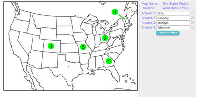
Make your own Map Assessment Exercise
Description: This activity allows teachers to make, save, and deploy interactive map quizzes to students. Choose and design any of 200 maps, then add interactive questions to the map. Save and name the map, copy the code, and distribute the code to students. Students click on the numbered circles on the map to access the questions. The system gives immediate feedback.

Belgium Interactive Map
Description: This is an interactive map of Belgium. Students simply click on the points of the map to learn all about Belgium.

Switzerland Interactive Map
Description: This is an interactive map of Switzerland. Students simply click on the points of the map to learn all about Switzerland.

Turkey Interactive Map
Description: This is an interactive map of Turkey. Students simply click on the points of the map to learn all about Turkey

Ukraine Interactive Map
Description: This is an interactive map of Ukraine. Students simply click on the points of the map to learn all about Ukraine.

Sweden Interactive Map
Description: This is an interactive map of Sweden. Students simply click on the points of the map to learn all about Sweden

Romania Interactive Map
Description: This is an interactive map of Romania. Students simply click on the points of the map to learn all about Belgium.

Serbia Interactive Map
Description: This is an interactive map of Serbia. Students simply click on the points of the map to learn all about Serbia.

Slovakia Interactive Map
Description: This is an interactive map of Slovakia. Students simply click on the points of the map to learn all about Slovakia.

Poland Interactive Map
Description: This is an interactive map of Poland. Students simply click on the points of the map to learn all about Slovakia.

Denmark Interactive Map
Description: This is an interactive map of Denmark. Students simply click on the points of the map to learn all about Denmark.

Iceland Interactive Map
Description: This is an interactive map of Iceland. Students simply click on the points of the map to learn all about Iceland.

Germany Interactive Map
Description: This is an interactive map of Germany. Students simply click on the points of the map to learn all about Germany.

Greece Interactive Map
Description: This is an interactive map of Greece. Students simply click on the points of the map to learn all about Greece.
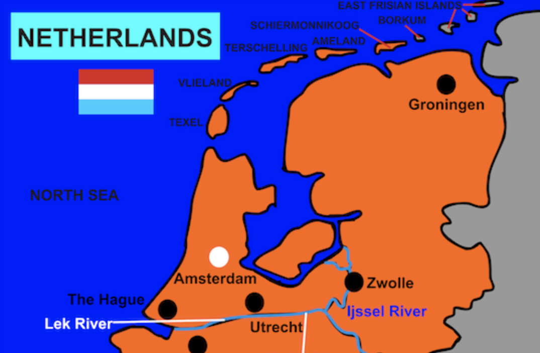
The Netherlands Interactive Map
Description: This is an interactive map of The Netherlands. Students simply click on the points of the map to learn all about The Netherlands.
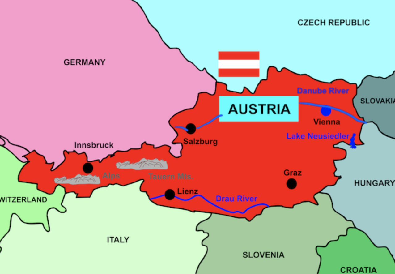
Austria Interactive Map
Description: This is an interactive map of Austria. Students simply click on the points of the map to learn all about Austria.

Hungary Interactive Map
Description: This is an interactive map of Hungary. Students simply click on the points of the map to learn all about Hungary.

Latvia Interactive Map
Description: This is an interactive map of Latvia. Students simply click on the points of the map to learn all about Latvia.

Russia Interactive Map
Description: This is an interactive map of Russia. Students simply click on the points of the map to learn all about Russia.

Albania Interactive Map
Description: This is an interactive map of Albania. Students simply click on the points of the map to learn all about Albania.
Advertisement
