
Advertisement
France Interactive Map and Map Activities
This section contains a clickable interactive map of France and associated interactive and printable activities, including scavenger hunts!

France Interactive Map
Description: This interactive map allows students to learn all about France's cities, landforms, landmarks, and places of interest by simply clicking on the points of the map.

France Printable Scavenger Hunt
Description: This scavenger hunt is designed for use with the France interactive map.

France Map Quiz - Online
Description: This France map quiz requires students to identify bordering nations, bodies of water, and important land features within France. It gives immediate feedback
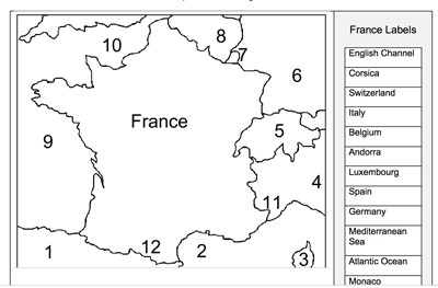
France Label-me Quiz
Description: This printable France label-me quiz requires students to label France's surrounding nations and bodies of water.

France Map Skills Quiz - Online
Description: This France map skills quiz requires students to find the relative positions of French cities and landmarks using north, east, west, south, northeast, northwest, southeast, and southwest. It gives immediate feedback.

France Map Skills Quiz - Printable
Description: This France map skills quiz requires students to find the relative positions of French cities and landmarks using north, east, west, south, northeast, northwest, southeast, and southwest. It gives immediate feedback.

France Outline Map
Description: This France outline map is perfect for coloring or labeling.
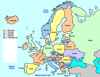
Europe Interactive Map
Description: This interactive map allows students to learn all about the european nations simply clicking on the points of the map.
Advertisement
