
Advertisement

World Geography Games
This section contains 25 colorful and highly entertaining geography games for learners in first grade, second grade, third grade, fourth grade, fifth grade, sixth grade, and middle school! These challenging geography games cover a wide range of topics including continent and nations identification, latitude and longitude, World Landforms, map scale, cardinal directions, and much more.

Interactive World Map and World Map Games
Description: This is an incredible map of the world that allows students to explore an interactive map of the world, or, play games testing their knowledge of the nations or waterways of the world. Works on all devices!

Continents and Oceans - Online Game
Description: This fun online game requires students to drag and drop the labels for the seven continents and the five oceans while the Earth is spinning. It is LOTS of fun, however, the game is very particular about where the labels are dropped.

Postcards From Around the World
Description: Postcards From Around the World is an interactive geography and art activity that lets students explore famous landmarks from around the globe while creating personalized postcards. Students can color or view real photographs, learn interesting facts, listen to narration, write a postcard message, and save or print their finished work. With an interactive map, detail zoom, and creative tools, the activity combines geography, history, literacy, and art in an engaging, hands-on learning experience.

World Map Sigma
Description: World Map Sigma is an interactive geography activity where students color, label, and annotate a blank world map using creative tools and movable stamps. The activity helps learners identify continents and oceans, place correct labels, and customize their map with symbols, text, and artistic elements. By combining creativity with geographic accuracy, World Map Sigma promotes both spatial understanding and visual learning.

International Pizza Delivery – Free Latitude and Longitude Game
Description: In International Pizza Delivery, users must deliver pizzas to all corners of the world using their latitude and longitude skills. The object is to deliver as many pizzas as possible in three minutes. For each successful delivery, the user earns the flag of the nation in which the pizza was delivered to. These flags may be printed out at the end of the game.
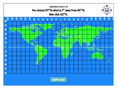
Latitude and Longitude Game – Coordinates
Description: Coordinates is a free online latitude and longitude game that helps students practice world geography and map skills. In Coordinates, students learn latitude and longitude while learning the locations and names of the world’s nations. First, students are prompted to find the latitude coordinate. Once the latitude coordinate is found, the game locks the latitude position and the longitude lines animate into the map. Finally, students are prompted to find a point of longitude. If the clicked coordinates are close enough to the actual coordinates that they occur in the same nation, the student will have the opportunity to “guess” the name of the nation. If correct, students earn the flag of the nation that appears in the flags panel. Students also have 100 “coordinate points” to work with. If the actual coordinate is 95 degrees west and the student chooses 90 degrees, he or she will lose five coordinate points reducing the total, for example, to 95. The game ends when the student has no coordinate points left.

Not Boring Jeopardy - World Landforms Edition
Description: This is a "jeopardy" like game on World Landforms. It's super fun for classrooms, individuals, or small teams, totally customizable. Uncheck "teams take turns" to make it more exciting for kids.

Postcards Across America - Online
Description: The Digital Postcard Creator is an interactive web tool that lets students color digital images of American landmarks, national parks, and city skylines while writing their own postcard messages beside them. It encourages creativity, research, and writing skills by combining art, geography, and technology into one engaging activity.

50 State Word Search Wars
Description: These interactive five-level word searches challenge players to find all 50 U.S. state names (or capitals) hidden in a colorful red, white, and blue grid. Each level increases in difficulty and urgency, with a countdown timer, celebratory screens, sound effects, and click-and-drag word highlighting that makes learning geography fun and engaging.

GPS Master
Description: “GPS Down!” is an interactive mapping game where students plan road-trip routes between assigned U.S. cities without GPS, choosing contiguous interstates and directions. Using a draggable, rotatable map scale, they estimate total mileage, then compute time (at 60 mph), fuel use (25 mpg), cost ($3.50/gal), and fuel stops (400-mile range). The app grades route accuracy and estimates, giving a report card and side-by-side comparison to the actual values to reinforce map reading, measurement, and real-world math.

Collage America
Description: Collage America is a free United States geography game and art activity in which students build a map of the USA by dragging each state into its correct location. Students can choose from different illustrated versions of each state to create a unique map while practicing state names, locations, and U.S. geography.

Conquer the States
Description: This fun United States geography game challenges students to identify as many states on the United States map as possible in 60 seconds.

Mailroom Madness!
Description: In Mailroom Madness, you pick your home state and rapidly sort letters and boxes—each with a full fictional address—into the correct one of two regional bins (E/W or N/S). Race the three-minute clock, earn bonus time for streaks, watch trucks swap out every 20 correct, and avoid the big red ✕—five mistakes and you’re fired. Finish to receive a printable certificate showing deliveries, errors, percent correct, and your Mail Sorter Grade (up to “Supreme Leader of All Mail Carriers A++”).

The Eagle and the Flag
Description: In The Eagle and the Flag, players drag a bald eagle onto each U.S. state named on the screen, lighting up that state’s star on the flag if they’re correct. With only one chance per state, kids race the clock to complete all 50 stars while earning streak bonuses and feedback from their “eagle coach.”

Burnside's Billions
Description: This innovative game requires students to "purchase" as many of the world's most important landmarks as possible with ten billion dollars. Students must purchase by using the game's tools to convert dollars to the native currency. For example, to buy the Eiffel tower, players must convert dollars to euros. The game provides real-time currency exchange rates and has numerous twists and turns. Games can be saved! For more detailed video instructions, check out the Burnside Billion's instructional video.

Habitat Maker - Online Game
Description: This totally fun simulation allows students to create up to five different habitats with a selection of customizable, cartoonish animals and plants that belong in the habitats. In additions, students can enter the "lost dimension" where they can craft their own animals from the parts of different animals! Classified under: Science game, science games, animal game, animal games, habitat game, habitat games

Death to Decimals
Description: This fun game requires students to role play as Fraction Man - a super hero who must save the world from horrible, parachuting decimal aliens by converting them to harmless fractions. math game, math games, decimal game, decimal games, decimals game, decimals games, fraction game, fraction games, fractions game, fractions games

Conquer the Continents - Online Game
Description: How many nations can you identify from the chosen continent in 60 seconds?

Continental Simon - Online Game
Description: This fun game functions just like the classic game Simon - the only difference is that students must remember the continents that light up rather than colors.

World Detective - Online Game
Description: In World Detective, students select a continent and the "game" selects a secret country within the chosen continent. The player has six questions to try to guess the selected state. Users must generate "good" questions that allow them to eliminate as many incorrect states as they can per question. Students can ask questions regarding color or relative location. States that are eliminated are grayed out. For example, a good first question might be "is the country east of Germany?" If the answer were to be yes, all of the countries west of Germany would then be greyed out.

Cardinal Directions - Online Game
Description: Choose from three different skill levels (left/right, north/east, west, south, or combinations) and see how many commands you can successfully follow in one minute.

Not Boring Jeopardy - United States Regions
Description: This is a "jeopardy" like game on U.S. regions. It's super fun for classrooms, individuals, or small teams, totally customizable. Uncheck "teams take turns" to make it more exciting for kids.

Animalia - Online Game
Description: How well do you know where in the world animals live? Drag and drop the animals to their continents. There are 31 total animals. If you correctly place 28 or more, you can print out a gold medal certificate with one of the animals. There are 31 total certificates you can earn, so play often and trade with your friends to collect them all.

Map Scale - Online Game
Description: This fun online game reinforces the concept of map scale by challenging students to determine the distances between major world cities.

Temperature Map - Online Game
Description: How well can you add and subtract both positive and negative numbers? Temperature Map requires students to add and subtract both positive and negative numbers in specially-designed word problems to determine the temperatures of ten cities around the world. This game serves as an enjoyable way for students to practice adding and subtracting positive and negative numbers, improve number sense, and to learn a little bit about world geography and climate, and each city’s temperature in the game is within the range of its actual normal temperatures in summer or winter.

Collage World - Online
Description: This awesome resource allows students to make online collages featuring a continent of choice and its nations. Great world geography practice and collages print beautifully! Classified Under: Geography game, USA geography, USA geography game, Geography games, USA geography games, USA game, USA games, World geography, World Geography game, World Geography games,
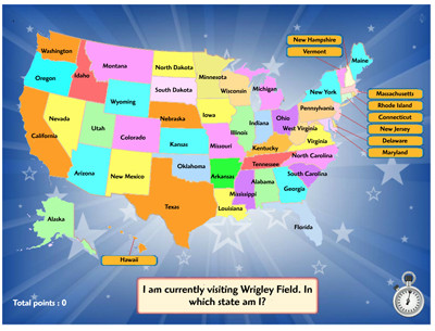
Where in the USA is Mr Nussbaum?
Description: This United States geography game challenges students to identify the state locations of as many USA Landmarks, Capitals, or Cities as possible in two minutes. Students can choose from the three aforementioned categories.
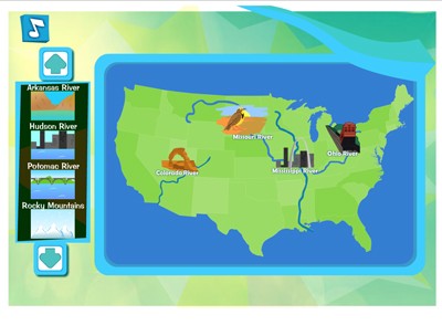
Landforms Central
Description: This educational game requires students to drag and drop the animated landforms and bodies of water to their correct places on the map of America. Examples include the Mississippi and Missouri Rivers, the Rocky Mountains and many others.
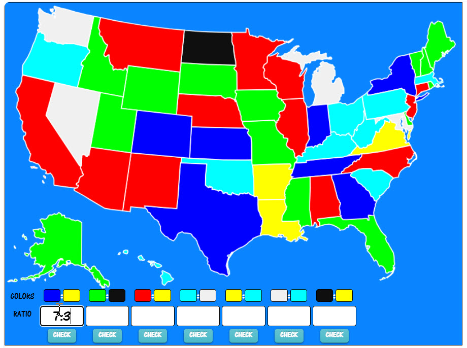
Ratio America: A Math and Geography Game About Ratios
Description: Turn the United States ablaze in color, then determine the ratios of the states relative to color. For example, if there are five blue states and three red states, the ratio of blue states to red states is 5:3. Choose from 2, 3, 4, 5, 6, 7, or 8 colors. Print out a beautiful map with all of the correct ratios when you are finished.
Advertisement
