

United States Landmarks and Land Regions - Interactive Maps and Map Activities
This section includes a national parks interactive map and associated scavenger hunts and activities.
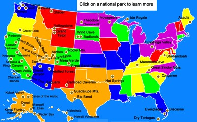
National Parks Interactive Map
Description: This section features an interactive map of America's 58 national parks. Clicking on the map allows students to learn about the national park of interest, as well as watch a narrated video. Students can learn about Yellowstone, Yosemite, Death Valley, Everglades, Denali, Rocky Mountain, Arches, and many more. Perfect for state reports or reports on America's national parks.
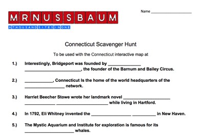
National Parks Scavenger Hunt
Description: This is designed to be used with the National Parks Interactive Map.

Postcards Across America - Online
Description: The Digital Postcard Creator is an interactive web tool that lets students color digital images of American landmarks, national parks, and city skylines while writing their own postcard messages beside them. It encourages creativity, research, and writing skills by combining art, geography, and technology into one engaging activity.

Postcards Across America
Description: This fun activity requires students to become familiar with America's national parks (or cities, landforms, landmarks, or states) by visiting the National Parks Interactive Map. Students pretend they are embarking on a tour of America's national parks and must write a postcard (to whomever they want) from four national parks (or states, cities, landmarks, or landforms). Each postcard must include a colorful picture and a brief description and/or history of the setting. An example is provided. Great project opportunity that integrates writing, reading, art, and U.S. geography.
Advertisement
