

United States Landforms and Land Regions - Coloring Pages
This section includes coloring pages related to American landforms and land regions.

Postcards Across America - Online
Description: The Digital Postcard Creator is an interactive web tool that lets students color digital images of American landmarks, national parks, and city skylines while writing their own postcard messages beside them. It encourages creativity, research, and writing skills by combining art, geography, and technology into one engaging activity.

Grand Canyon Coloring Page
Description: This is a beautiful outline of the Grand Canyon.

Yosemite National Park Coloring Page
Description: This coloring page features a beautiful outline of Half-Dome within Yosemite National Park.

Niagara Falls Coloring Page
Description: This is a printable Niagara Falls Coloring Page

Imagine: Shenandoah National Park
Description: This activity provides a vivid description of Shenandoah National Park. Based on the description, students must draw and color the scene described.

Imagine: Great Smoky Mountains
Description: This exercise provides a vivid description of a scene at Great Smoky Mountains National Park and requires students to draw it using their imagination. Imagery to Canvas.

Imagine: Everglades National Park
Description: This activity provides a vivid description of a scene from Everglades National Park and requires students to draw based on their interpretation. Imagery to Canvas

Imagine: Yellowstone National Park
Description: This activity requires students to read a short but vivid description of a scene within Yellowstone National Park and to use their imagination to translate to a picture. Imagery to Canvas.

Imagine: Arches National Park
Description: This activity requires students to draw and color a scene from Arches National Park based on a vivid description. Imagery to Canvas
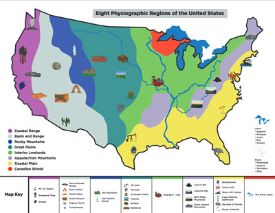
Eight United States Land Regions Infographic and Outline Map
Description: This awesome .pdf contains a beautifully illustrated map of the eight United States land regions with icons of various landforms and attractions found in each. It also contains a regions outline map on page 2.
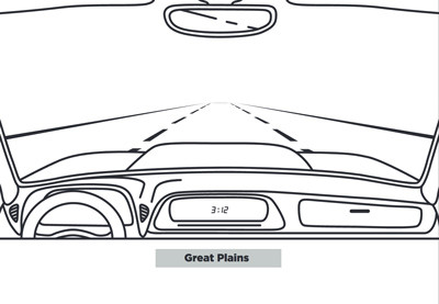
Eight United States Land Regions - Road Trip Across America
Description: This awesome activity includes eight pdfs. - one for each of America's eight land regions. The .pdf includes a giant windshield in which students should draw a scene they would see if they were on a road trip through each region. For example, if a student were to drive through the Basin and Range region, they might draw a desert landscape, or arches, or interesting rock formations. On the second page, students will find four "welcome to.." signs. Students should indicate four states they might drive through in each region. For example, in the basin and range region, students might design a "Welcome to Arizona" sign or a "Welcome to Utah" design.
Advertisement
