
Interactive Nations Maps
This section contains interactive maps, statistics, interesting facts, and flag explanations for dozens of nations. Students simply click on points of the map to learn all about each nation's cities, landforms, waterways, landmarks, mountains, and more. Great for research!

Albania Interactive Map
Description: This is an interactive map of Albania. Students simply click on the points of the map to learn all about Albania.
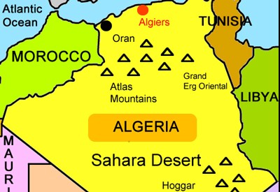
Algeria Interactive Map
Description: This is an interactive map of the Sahara Desert nation of Algeria. Students simply click on the points of the map to learn all about Algeria.

Angola Interactive Map
Description: This is an interactive map of Angola. Students simply click on the points of the map to learn all about Angola.

Argentina Interactive Map and Interesting Facts
Description: This interactive map allows students to click on the points of interest in Argentina to learn detailed information. The page also includes the nation's flag and meaning, and ten interesting facts.

Australia and Oceania interactive Map
Description: This interactive map allows students to learn all about the history and features of Australia and Oceania. Simply click and learn.
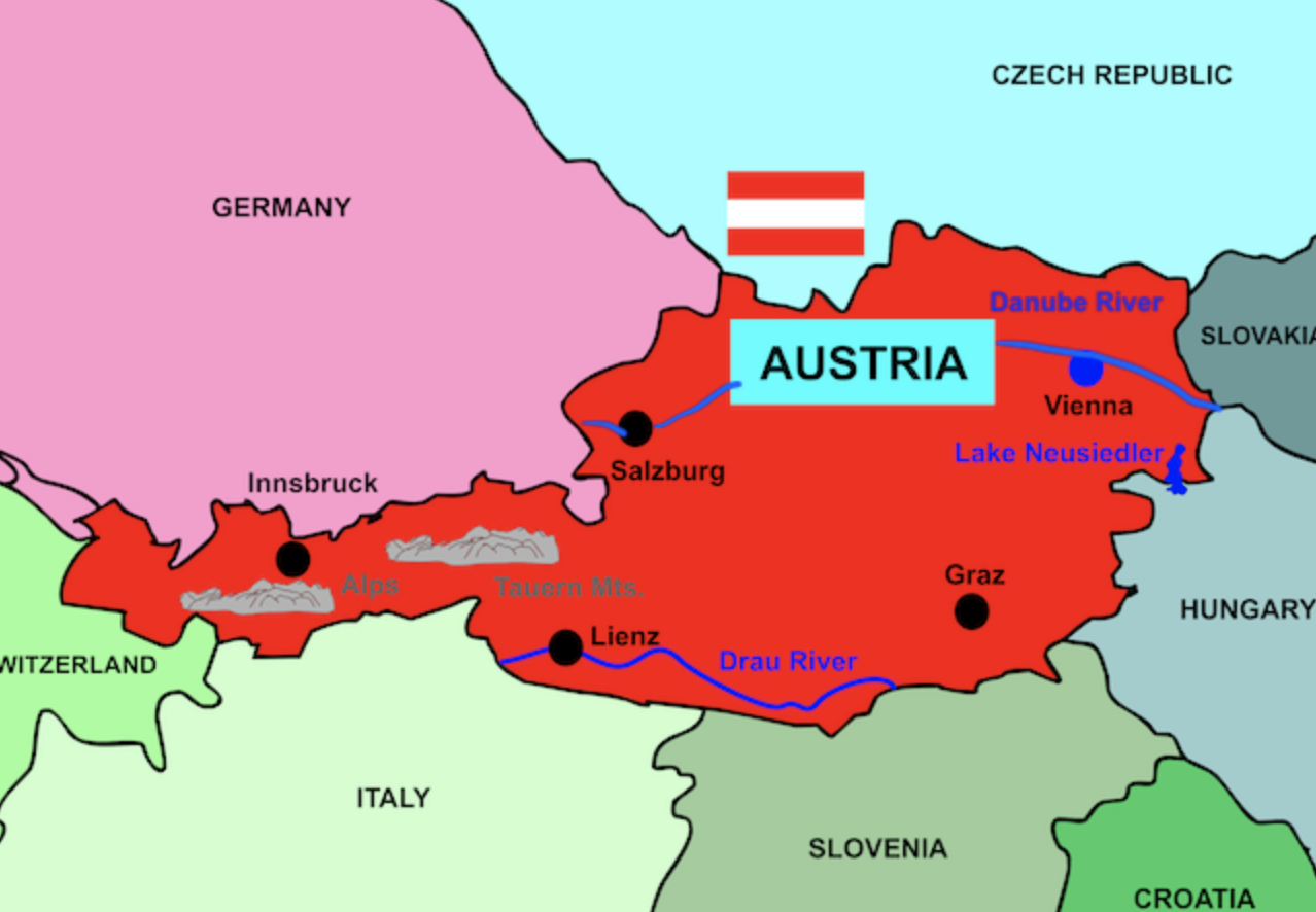
Austria Interactive Map
Description: This is an interactive map of Austria. Students simply click on the points of the map to learn all about Austria.

Belgium Interactive Map
Description: This is an interactive map of Belgium. Students simply click on the points of the map to learn all about Belgium.

Brazil Interactive Map
Description: This interactive map allows students to learn all about Brazil's cities, landforms, landmarks, and places of interest by simply clicking on the points of the map.
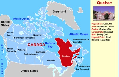
Canada Interactive Map
Description: This interactive map allows students to learn all about Canada's provinces by simply clicking on the points of the map.
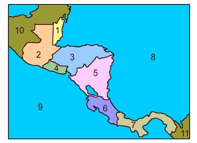
Central America Interactive Map
Description: This interactive map of Central America allows students to click on any of the Central American nations to access interactive maps. Includes interactive maps of Belize, Costa Rica, Honduras, Guatemala, El Salvador, Nicaragua, and Panama.

Chile Interactive Map and Interesting Facts
Description: This interactive map of Chile allows students to click on points of interest to learn about them. In addition, the page features interesting facts, statistics, and the symbolism of the flag.

Colombia Interactive Map and Interesting Facts
Description: This interactive map allows students to click on the points of the map to learn about them. It also provides interesting facts and historical information.
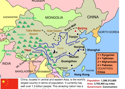
China Interactive Map
Description: This interactive map allows students to learn all about New China's cities, landforms, landmarks, and places of interest by simply clicking on the points of the map.

Denmark Interactive Map
Description: This is an interactive map of Denmark. Students simply click on the points of the map to learn all about Denmark.
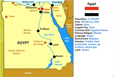
Egypt Interactive Map
Description: This is an interactive map of the Egypt. Students simply click on the points of the map to learn all about them.

Greece Interactive Map
Description: This is an interactive map of Greece. Students simply click on the points of the map to learn all about Greece.

Germany Interactive Map
Description: This is an interactive map of Germany. Students simply click on the points of the map to learn all about Germany.

France Interactive Map
Description: This interactive map allows students to learn all about France's cities, landforms, landmarks, and places of interest by simply clicking on the points of the map.

Hungary Interactive Map
Description: This is an interactive map of Hungary. Students simply click on the points of the map to learn all about Hungary.
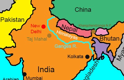
India Interactive Map
Description: This interactive map allows students to learn all about India's cities, landforms, landmarks, and places of interest by simply clicking on the points of the map.

Indonesia Interactive Map and Profile
Description: This is a beautiful interactive map of Indonesia. Students simply click on the points of the map to learn more.
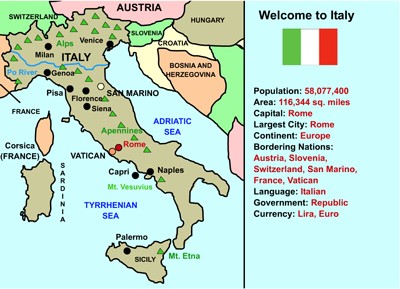
Italy Interactive Map
Description: This interactive map allows students to learn all about Italy's cities, landforms, landmarks, and places of interest by simply clicking on the points of the map.

Japan Interactive Map
Description: This is an interactive map of Japan. Students simply click on the points of the map to learn all about Japan.

Kenya Interactive Map
Description: This interactive map allows students to learn all about Kenya's cities, landforms, landmarks, and places of interest by simply clicking on the points of the map.

Latvia Interactive Map
Description: This is an interactive map of Latvia. Students simply click on the points of the map to learn all about Latvia.

Mali Interactive Map
Description: This is an interactive map of the Sahara Desert nation of Mali. Students simply click on the points of the map to learn all about Mali.

Libya Interactive Map
Description: This is an interactive map of the Sahara Desert nation of Libya. Students simply click on the points of the map to learn all about Mali.
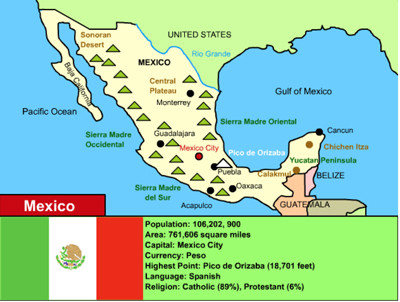
Mexico Interactive Map
Description: This is an interactive map of Mexico. Students simply click on the points of the map to learn all about Mexico.

Morocco Interactive Map
Description: This is an interactive map of the Sahara Desert nation of Morocco. Students simply click on the points of the map to learn all about Morocco.
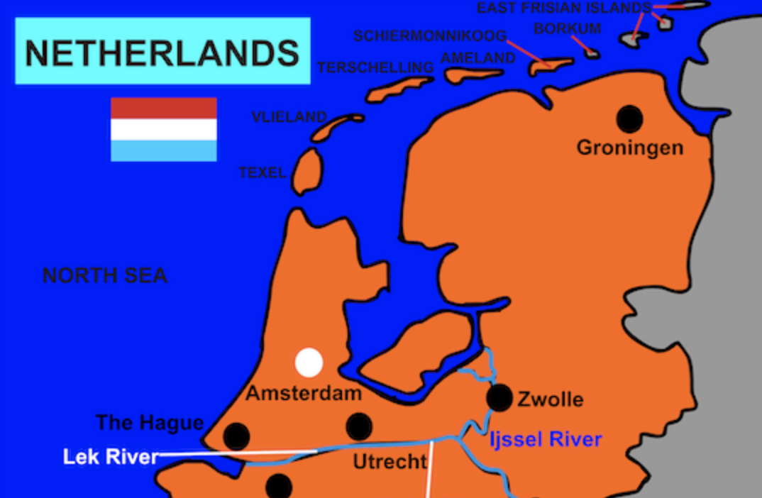
The Netherlands Interactive Map
Description: This is an interactive map of The Netherlands. Students simply click on the points of the map to learn all about The Netherlands.

Poland Interactive Map
Description: This is an interactive map of Poland. Students simply click on the points of the map to learn all about Slovakia.

Peru Interactive Map and Interesting Facts
Description: This interactive map of Peru allows students to click on points of interest to learn about them. In addition, the page features interesting facts, statistics, and the symbolism of the the flag.

Slovakia Interactive Map
Description: This is an interactive map of Slovakia. Students simply click on the points of the map to learn all about Slovakia.

Romania Interactive Map
Description: This is an interactive map of Romania. Students simply click on the points of the map to learn all about Belgium.

Russia Interactive Map
Description: This is an interactive map of Russia. Students simply click on the points of the map to learn all about Russia.

Switzerland Interactive Map
Description: This is an interactive map of Switzerland. Students simply click on the points of the map to learn all about Switzerland.

Spain Interactive Map
Description: This is an interactive map of Spain. Students simply click the points on the map to learn more.

Sweden Interactive Map
Description: This is an interactive map of Sweden. Students simply click on the points of the map to learn all about Sweden

Tanzania Interactive Map and Interesting Facts
Description: This interactive map allows students to click on the points of interest in Tanzania to learn detailed information. The page also includes the nation's flag and meaning, and ten interesting facts.

Thailand Interactive Map
Description: This is an interactive map of the Thailand. Students simply click on the points of the map to learn all about them.

Tunisia Interactive Map
Description: This is an interactive map of the Sahara Desert nation of Tunisia. Students simply click on the points of the map to learn all about Tunisia.

Turkey Interactive Map
Description: This is an interactive map of Turkey. Students simply click on the points of the map to learn all about Turkey

Ukraine Interactive Map
Description: This is an interactive map of Ukraine. Students simply click on the points of the map to learn all about Ukraine.
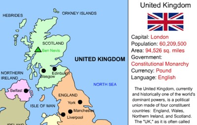
United Kingdom Interactive Map
Description: This interactive map allows students to learn all about the UK's cities, landforms, landmarks, and places of interest by simply clicking on the points of the map. Note - This is a flash activity that will not work on mobile devices.
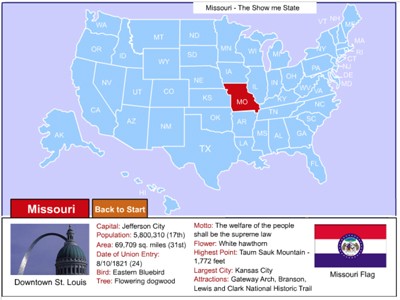
United States Interactive Map
Description: Click on any state in the United States map to learn about important facts such as symbols, area, population, motto, and more.

Venezuela Interactive Map and Interesting Facts - Online
Description: This beautiful interactive map allows students to click on any part of Venezuela to learn more about its cities, points of interest, and rivers. It also provides ten interesting facts about Venezuela as well as statistics and information about its flag. Perfect for country reports!
Advertisement
