

United States - Regions
This section provides interactive and printable maps and activities for the following regions: New England, Mid-Atlantic, Southern, Midwestern, Southwestern, and Western.

United States Regions Learning Lab 2.0
Description: Explore all 50 states with the United States Regions Learning Lab! This comprehensive interactive program features five regional learning labs: New England, Mid-Atlantic, Southern States, Midwest, and Western States. Students can explore clickable maps featuring major cities, mountain ranges, landforms, historical landmarks, and state information. Each region includes narrated informational articles, interactive state identification challenges, randomized 15-question scavenger hunts with printable answer keys, and an advanced Map Creator for coloring, labeling, drawing, and designing customized maps. Special features include regional zoom tools, a Great Lakes Explorer, and selected landmark photographs. Perfect for grades 3–7, this program brings American geography, history, and map skills together in one engaging learning experience!

New England Interactive Map
Description: This interactive map allows students to learn all about New England's states, cities, landforms, landmarks, and places of interest by simply clicking on the points of the map.
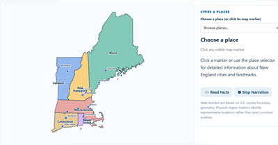
New England Interactive Map and Learning Lab 2.0
Description: Explore the six New England states with this comprehensive interactive geography program! Students can discover important cities, mountain ranges, physical regions, and historical landmarks, including a special zoomable Boston map. Click locations to read detailed information or listen to narrated descriptions. Activities include a Region Challenge, a randomized 15-question online and printable scavenger hunt, and an advanced Map Creator where students can color states, add and move labels, draw, customize, and print their own maps. Perfect for geography, history, and social studies instruction!
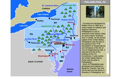
Mid-Atlantic States Interactive Map
Description: This interactive map allows students to learn all about the Mid-Atlantic states, cities, landforms, landmarks, and places of interest by simply clicking on the points of the map.

Mid-Atlantic States Interactive Map and Learning Lab 2.0
Description: Explore the five Mid-Atlantic states—New York, New Jersey, Pennsylvania, Delaware, and Maryland—with this comprehensive interactive Geography & History Learning Lab! Students can explore clickable maps featuring important cities, mountain ranges, landforms, and historical landmarks, with detailed mini-articles and narration. Special features include a New York City Five Boroughs Explorer, a State Challenge, randomized 15-question online and printable scavenger hunts, and an advanced Map Creator where students can color states, add and move labels, draw, and print customized maps. Perfect for geography, history, and social studies instruction!

Southern States Interactive Map
Description: This interactive map allows students to learn all about the states, cities, landforms, landmarks, and places of interest in the American South by simply clicking on the points of the map.

Southern States Interactive Map and Learning Lab 2.0
Description: Explore the geography and history of the 14 Southern states with this comprehensive interactive Learning Lab! Students can investigate clickable maps featuring important cities, mountain ranges, landforms, and historical landmarks, with detailed mini-articles and narration. Explore state facts and symbols, switch to photographic Landforms View, and zoom into different regions of the South. Activities include a State Challenge, randomized 15-question online and printable scavenger hunts, and an advanced Map Creator where students can color states, add and move labels, draw, and print customized maps. Perfect for geography, history, and social studies instruction!
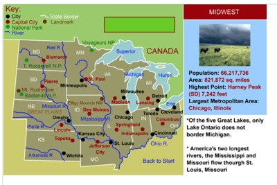
Midwestern States Interactive Map
Description: This interactive map allows students to learn all about the cities, landforms, landmarks, and places of interest of the midwestern states by simply clicking on the points of the map.

Midwestern States Interactive Map and Learning Lab 2.0
Description: Explore the 12 Midwestern states with this comprehensive interactive Geography & History Learning Lab! Students can investigate clickable maps featuring important cities, mountain ranges, landforms, and historical landmarks, with detailed mini-articles and narration. A special Great Lakes Explorer features an accurate, interactive map of all five Great Lakes. Additional activities include Midwest State Quest, a randomized 15-question online and printable scavenger hunt, and an advanced Map Creator where students can color states, add and move labels, draw, and print customized maps. Perfect for geography, history, and social studies instruction!
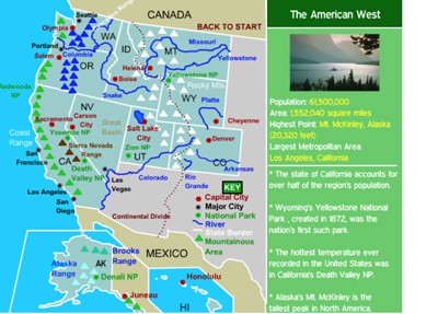
Western States Interactive Map
Description: This interactive map allows students to learn all about the states, cities, landforms, landmarks, and places of interest in the American West, by simply clicking on the points of the map.
Western States Interactive Map and Learning Lab 2.0
Description: Explore the geography and history of America's 13 Western states with this comprehensive interactive Learning Lab! Students can investigate clickable maps featuring major cities, mountain ranges, landforms, national parks, and historical landmarks, with detailed mini-articles, photographs of famous landmarks, and narration. Explore state flags and symbols, zoom into different regions, and discover natural wonders such as the Grand Canyon, Yellowstone, Death Valley, and the Rocky Mountains. Activities include Western State Quest, randomized 15-question online and printable scavenger hunts, and an advanced Map Creator where students can color states, add and move labels, draw, and create customized maps. Perfect for geography, history, and social studies instruction!

New England EPIC Activity Packet
Description: This is one of the paid MrNussbaum resources on Teachers Pay Teachers. It contains nearly 100 New England-themed activities including numerous reading comprehension exercises on New England topics, maps and map exercises, state symbols, mazes, and much, much more. This is a $13.00 value free with your subscription to MrN 365.

Southwestern States Interactive Map
Description: This interactive map allows students to learn all about the southwest's states, cities, landforms, landmarks, and places of interest by simply clicking on the points of the map.

Four Regions of California Map and Map Maker
Description: Explore California’s four geographic regions with this interactive map and map creator! Discover the Coastal, Mountain, Central Valley, and Desert regions through clickable maps, narrated information, and landscape photographs. Complete a movable 10-question interactive scavenger hunt with immediate feedback or print a version with an answer key. Students can also create their own California maps by coloring regions, drawing geographic features, and adding movable text labels. Finished maps can be printed or saved!

Five Regions of Georgia Map and Map Maker
Description: Explore Georgia’s five geographic regions with this interactive map and map creator! Discover each region’s landforms, climate, and natural resources through clickable maps, narrated information, and landscape photographs. Complete an interactive 10-question scavenger hunt or print a version with an answer key. Students can also create their own Georgia maps by coloring regions, drawing, and adding movable text labels. Finished maps can be printed or saved!
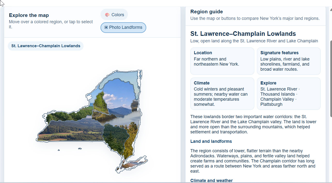
Eight Regions of New York Map and Map Maker
Description: Explore the Eight Land Regions of New York in this interactive geography adventure! Students can explore each region on an interactive map, learn about its location and physical features, and test their knowledge through engaging activities. The built-in Map Creator allows students to color, label, and customize their own New York land regions map. Perfect for classroom instruction, independent learning, and geography review!

Three Regions of North Carolina Map and Map Maker
Description: Explore Georgia’s five geographic regions with this interactive map and map creator! Discover each region’s landforms, climate, and natural resources through clickable maps, narrated information, and landscape photographs. Complete an interactive 10-question scavenger hunt or print a version with an answer key. Students can also create their own Georgia maps by coloring regions, drawing, and adding movable text labels. Finished maps can be printed or saved!

Five Regions of Pennsylvania Map and Map Maker
Description: Explore Pennsylvania's fascinating geographic regions with this interactive landforms explorer and map creator! Students can click or hover over the colorful map to learn about the state's mountains, valleys, plateaus, and lowlands through detailed descriptions and narration. Features include a photographic landscape map, a movable 10-question interactive scavenger hunt with immediate feedback, and a printable version with an answer key. The exciting Map Creator allows students to color regions, draw geographic features, and add, move, edit, or delete text labels. Finished maps can be printed or saved as PNG or SVG files. Perfect for Pennsylvania geography lessons, map skills, and independent exploration!

Four Regions of Texas Interactive Map and Map Maker
Description: Explore the four major regions of Texas with this interactive geography explorer and map creator! Students can click on the Coastal Plains, North Central Plains, Great Plains, and Mountains and Basins to discover detailed information about each region's landforms, climate, natural resources, and more. Features include narrated information, an interactive landscape photo collage, and a movable 10-question multiple-choice scavenger hunt with immediate feedback, plus a printable version with an answer key. The exciting Map Creator lets students design their own Texas map by coloring individual regions, drawing geographic features, and adding, editing, and moving text labels. Completed maps can be printed or saved as PNG or SVG files. Perfect for Texas geography lessons, map skills, and independent exploration!

Five Regions of Virginia Interactive Map and Map Maker
Description: Explore Virginia's five geographic regions with this interactive map and map creator! Students can click or hover over the Appalachian Plateau, Valley and Ridge, Blue Ridge Mountains, Piedmont, and Coastal Plain to discover fascinating information about each region's landforms, climate, natural resources, and more. Features include narrated information, a photographic landscape map, and a movable 10-question interactive scavenger hunt with immediate feedback, plus a printable version with an answer key. The exciting Map Creator lets students design their own Virginia map by coloring regions, drawing geographic features, and adding, moving, or deleting text labels. Finished maps can be printed or saved as PNG or SVG files. Perfect for Virginia Studies, geography lessons, and map skills practice!
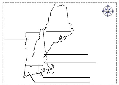
New England States Outline
Description: This is a New England outline map that students can color and label
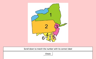
Mid-Atlantic States Label-me Quiz - Online
Description: This interactive quiz requires students to identify the Mid-Atlantic States. This gives immediate feedback.
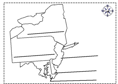
Mid-Atlantic States Label-me Quiz
Description: This quiz requires students to color and label the Mid-Atlantic states.
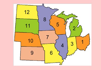
Midwestern States Label-me Quiz - Online
Description: This activity requires students to identify the midwestern states.
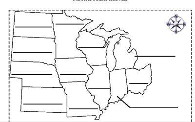
Midwestern States Label-me Map
Description: This is an outline of the Midwestern states for students to label and color.
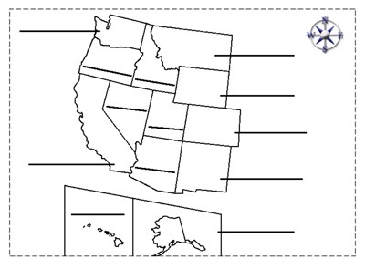
Western States Label-me Map
Description: This map requires students to label the states of the western United States.
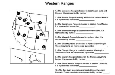
Western Ranges Identification
Description: This activity describes the various mountain ranges in the western United States and requires students to identify the states in which they occur.

Not Boring Jeopardy - United States Regions
Description: This is a "jeopardy" like game on U.S. regions. It's super fun for classrooms, individuals, or small teams, totally customizable. Uncheck "teams take turns" to make it more exciting for kids.
Advertisement
