Nicaragua |
|||||||||||||||||||||||||
|
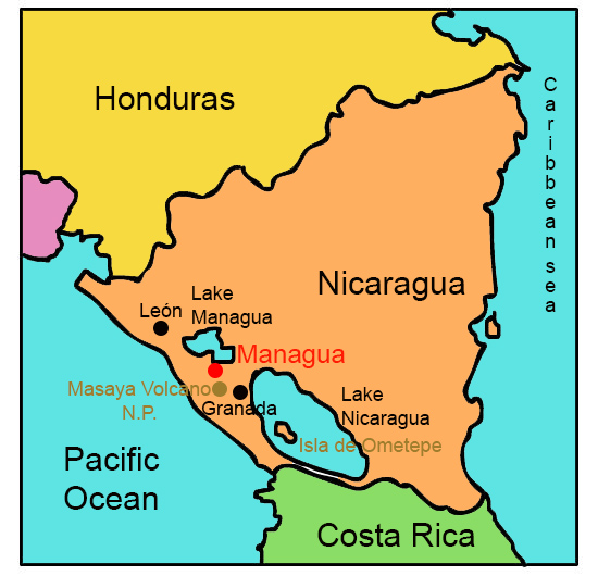
Click the points on the map to learn more.
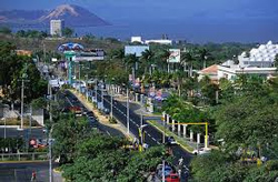 |
ManaguaManagua is the capital and largest city of Nicaragua. More than one quarter of the nation's population lives in or around the capital city. While original Managua was founded in 1819 as a rural fishing village, modern-day Managua was built in the 1850’s, and declared the capital in 1852. Because the city is built on a fault, it will likely be plagued by severe earthquakes at least every fifty years. In 1972, a powerful earthquake destroyed over 90 percent of the city and killed nearly 20,000 people. Managua has never fully recovered from the earthquake or the Nicaraguan Civil War of the early 1980s. Today, the chaotic city lacks a central downtown area, features hundreds of unmarked streets, and is considered confusing and dirty. |
| Back to Map | |
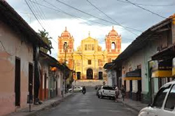 |
LeónNamed after León, Spain, León is one of the oldest cities in Nicaragua. First established in 1524, the city’s location was moved after a volcanic eruption caused extensive damage to the city in 1610. León is considered the intellectual capital of Nicaragua, mainly because of the founding of the National Autonomous University of Nicaragua in 1813. The university is the second oldest in all of Central America. León is well known for its Spanish Colonial architecture, including the popular Cathedral of the Assumption. |
| Back to Map | |
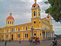 |
GranadaFounded in 1524, Granada was an important Spanish commercial trade harbor on the shores of Lake Nicaragua. It was one of he first European cities in mainland North America. During the 17th century, it was a frequent target of British pirates. Grenada has often been considered the nation's most beautiful city, which has resulted in the preservation of the city's colonial-era architecture. Today, Grenada has a thriving tourist industry and is the top tourist destination in Nicaragua. |
| Back to Map | |
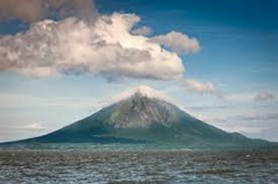 |
Lake ManaguaAlso known as Lago (lake) Xolotlán, Lake Managua is 40 miles long and 16 miles wide. It is severely polluted, as a result of decades of sewage being dumped into the lake (city sewers have drained into the lake since 1927). Some call it “the most contaminated lake in Central America.” Lake Managua is the only freshwater lake where sharks live. |
| Back to Map | |
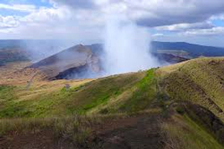 |
Masaya Volcano National ParkMasaya Volcano National Park features two volcanoes and five craters. Masaya Volcano is one of Nicaragua’s most active volcanoes, and last erupted in 2003. Tourists can enjoy the park for the unique vegetation and animals living in the area, still covered by rocks and volcanic ash. Visitors can also hike up the volcano and peer into the crater, which is continually emitting smoke and sulfur gases. |
| Back to Map | |
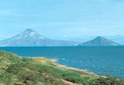 |
Lake NicaraguaAt 3,191 square miles in area, Lake Nicaragua is the 19th largest lake in the world, the 9th largest in the Americas, and the largest lake in Central America. Much like Lake Managua, however, Lake Nicaragua is one of the most polluted lakes in the world.
|
| Back to Map | |
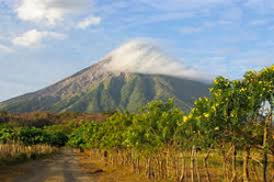 |
Isla de OmetepeOmetepe Island is located on Lago de Nicaragua (Nicaragua Lake), and is made up of two joined volcanoes - Concepción and Maderas. The island's history dates back thousands of years. Ancient peoples left pre-Columbian artifacts, petroglyphs, and carved stone idols scattered around the island. Past Indian inhabitants considered Ometepe as a sacred land. Today, the island hosts more religious and folk festivals than anywhere else in the country.
|
| Population: | 6,008,000 |
| Area: | 50,338 square miles |
| Capital City: | Managua |
| Largest City: | Managua |
| Currency: | Nicaraguan Córdoba |
| Official Language: | Spanish |
| GDP (Gross Domestic Product) | $11.26 billion |
- Nicaragua is the largest country in Central America
- The earliest settlers in Nicaragua were related to the Maya and Aztec people
- Lake Nicaragua, with an area of 3,191 square miles, is the largest lake in Central America
- About 42% of the country’s land is used for agriculture
- Although outsiders call the local people Nicaraguans, they call themselves Nicas
- Since the early 20th century, Nicaraguan men have been migrating to Costa Rica seasonally to harvest bananas and coffee
- Many Nicaraguans are descendants of the Africans brought by the British to work as slaves in the country in the 17th century
- Nicaragua’s only UNESCO World Heritage listing is León Viejo (old León), ruins dating back to the 16th century
- Nicaragua is the poorest country in Central America
- San Juan del Sur, Nicaragua is home to the second largest statue of Jesus in the world
|
|
 |
|
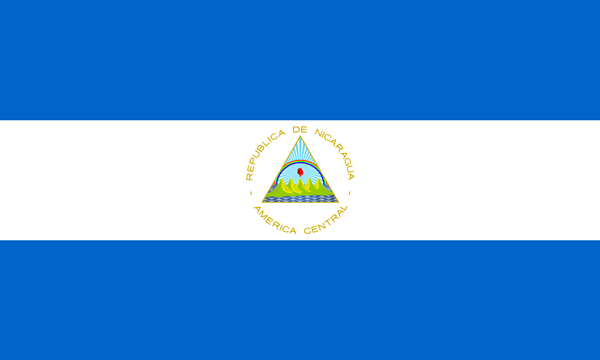
The blue stripes represent the Pacific Ocean and the Caribbean sea, while the white represents both the land between and the peace and prosperity of the Nicaraguan people. The equilateral triangle represents equality. Inside, five volcanoes symbolize the five member states of the federation, the cap of liberty represents freedom, and the sun rays and rainbow symbolize Nicaragua’s bright future |
|