Honduras |
||||||||||||||||||||||||
|
Click the points on the map to learn more.
 |
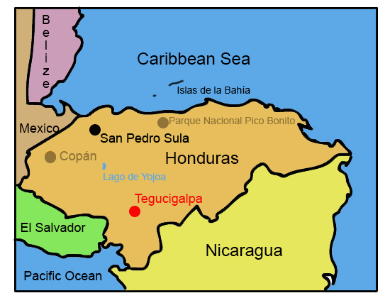
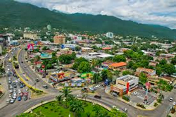
TegucigalpaTegucigalpa was founded in 1578 as a gold and silver-mining center, and became the permanent capital of Honduras in 1880. Tegucigalpa sits at an elevation of 3,200 feet above sea level, and has a population of 765,675. The city struggles primarily with poverty and rising crime rates, the former exacerbated by the devastation caused by Hurricane Mitch in 1998. |
| Back to Map | |
 |
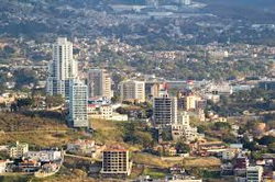
CopánFounded in 1570, Copán is one of the most important sites for Mayan ruins. The first evidence of civilization in the Copán Valley dates to 1500 BC, but the city reached its greatest period during AD 300-900. Major developments in mathematics, astronomy, and hieroglyphic writing were made in the city. The ruins were not excavated until the 19th century. Now they make up a UNESCO World Heritage Site |
| Back to Map | |
 |
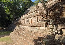
Lago de YojoaAt ten miles long and four miles wide, Lago de Yojoa (or Lake Yojoa) is the largest natural lake in Honduras. It is located between Santa Barbara National Park and Cerro Azul Meambar National Park in the western portion of Honduras. Tourists to the area enjoy not only the parks, but touring the coffee plantations, exploring caves and waterfalls, and finding area wildlife. |
| Back to Map | |
 |
San Pedro SulaSan Pedro Sula is the second largest city in Honduras and is considered the business and industrial capital of Honduras. It has a population of 490,000. Businesses and factories in the city contribute to nearly two-thirds of the country’s GDP. San Pedro Sula, however, is plagued with unemployment, poverty, and organized crime. It has one of the highest murder rates for any major city in the world and is thought to be a major distribution point for the illegal drug trade. |
| Back to Map | |
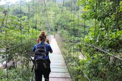 |
Parque Nacional Pico BonitoPico Bonito National Park is situated within a the Mesoamerican Biological Corridor, near the base of Pico Bonito, the third highest peak in Honduras. The terrain changes from tropical rain forest near the Caribbean shores, to high elevation cloud forest, to very dry forest in the Aguan Valley on the other side of the park. This geography provides several unique habitats for the numerous species of wildlife living in the park. |
| Back to Map | |
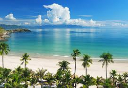 |
Islas de la BahíaRoatán, Utila, and Guanaja make up the three Islas de la Bahía (Bay Islands), located off the northern coast of Honduras. Tourists are drawn to the region's spectacular snorkeling and scuba diving. Surrounding the islands is the world's second largest barrier reef.
|
| Back to Map | |
| Population: | 8.1 million |
| Area: | 43,433 square miles |
| Capital City: | Tegucigalpa |
| Largest City: | Tegucigalpa |
| Currency: | Honduran Lempira |
| Official Language: | Spanish |
| GDP (Gross Domestic Product) | $18.5 billion |
- Honduras became an independent nation in 1821
- Honduras is considered a hidden gem in Central America, with some of the best beaches, islands, and scuba diving sites in the Western Hemisphere
- The terrain of Honduras is mostly mountainous and forested
- Honduras means “depths” in Spanish
- Honduras was named by Christopher Columbus
- Primary exports of Honduras include coffee and bananas
- Honduras is one of the poorest countries in Latin America, with more than half of the population living in poverty
- The national bird of Honduras is the Scarlet Macaw
- 97% of Hondurans are Catholic.
- The economy of Honduras is heavily dependent on the United States
|
|
 |
|
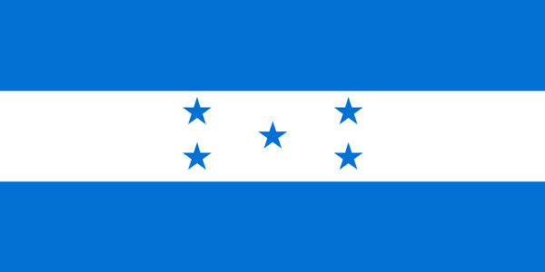
The blue stripes represent the Pacific Ocean and Caribbean Sea, with the white band in the middle representing both the land in between the two bodies of water, and the peace and prosperity of the people. The five stars represent the members of the former Federal Republic of Central America. |
|