Belize |
||||||||||||||||||||||||
|
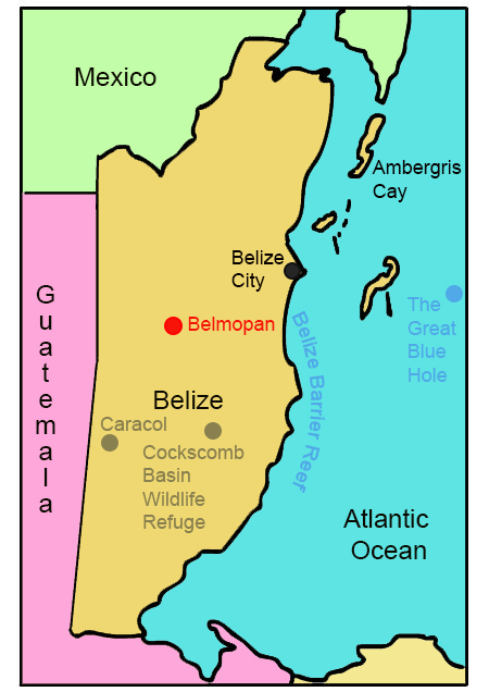
Click the points on the map to learn more.
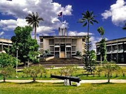 |
BelmopanWith a population of 16,451, Belmopan is one of the smallest and newest capital cities in the world. The name was formed from the combination of "Belize" and "Mopan," the nation's longest river. After Hurricane Hattie destroyed Belize City in 1961, Belmopan’s site was chosen because of its location inland, relatively sheltered from tropical storms. Construction on the city started in 1967 as a planned community. |
| Back to Map | |
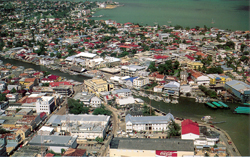 |
Belize CityBelize City is the largest city in Belize. Its population is nearly five times larger than Belmopan, the nation's capital. Belize City was the former capital of the nation (which was then called British Honduras). In 1961, however, Hurricane Hattie largely destroyed the city, and the capital was moved inland. Today, most tourists visit Belize City only as a transportation hub. Belize City reamins the cultural and financial center of Belize. |
| Back to Map | |
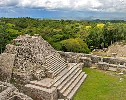 |
CaracolCaracol is the largest Maya site in Belize. It once held a population of approximately 150,000, as one of the largest ancient Maya cities. Over 40 of its monuments were built between 484 and 889 AD. It still holds Belize’s tallest manmade structure - Canaa (Sky Place), at 143 feet tall. |
| Back to Map | |
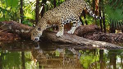 |
Cockscomb Basin Wildlife RefugeCockscomb Basin Wildlife Sanctuary is widely recognized as the world’s first jaguar preserve. It was declared a wildlife sanctuary in 1986, as scientists found that the Cockscomb Basin contained the highest density of jaguars ever recorded. It has since expanded from the original 3,600 acres to 128,000 acres. Besides jaguars, the sanctuary holds hundreds of species of plants and insects, as well as up to 300 recorded bird species. |
| Back to Map | |
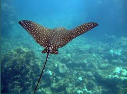 |
Belize Barrier ReefThe Belize Barrier Reef is a 190 mile-long section of the Mesoamerican Barrier Reef, the second largest coral reef in the world. It attracts almost half of all Belize’s tourists, making it the most popular destination in Belize. It includes seven marine reserves and 450 cays, as well as the Great Blue Hole, the most famous dive destination in Belize. |
| Back to Map | |
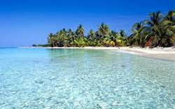 |
Ambergris CayAmbergris Caye (pronounced ‘key’) is the largest of Belize’s several hundred islands. Separated by Mexico’s Yucatan Peninsula by a small channel, the island is 25 miles long, and ranges in width from a few hundred feet to four miles. During the 17th century the island was a favorite hiding place for pirates; since the 1980’s, tourism has boomed, mainly because of snorkeling and diving opportunities nearby.
|
| Back to Map | |
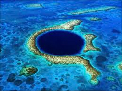 |
Great Blue HoleThe Great Blue Hole is a massive oceanic sinkhole (underwater cave) located 43 miles east of Belize City. It is 407 feet deep and nearly 1,000 feet across. The Great Blue Hole is considered one of the greatest scuba diving locations in the world and is famous for its amazing stalactites. Recently, the Dsicovery Channel named it one of world's top ten most amazing places.
|
| Population: | 331,900 million |
| Area: | 8,890 square miles |
| Capital City: | Belmopan |
| Largest City: | Belize City |
| Currency: | Belize Dollar |
| Official Language: | Spanish |
| GDP (Gross Domestic Product) | $1.624 billion |
- Belize is the only Central American country that doesn’t have coastline on the Pacific Ocean
- Although the official language is English, residents salso speak Creole, Maya, German, and Garifuna, among other languages
- Belize is the only Central American country where English is the official language
- The former name of Belize was British Honduras
- the world's second largest barrier reef surrounds the entire coastline if Belize
- Mayan artifacts in Belize data back 3,500 years.
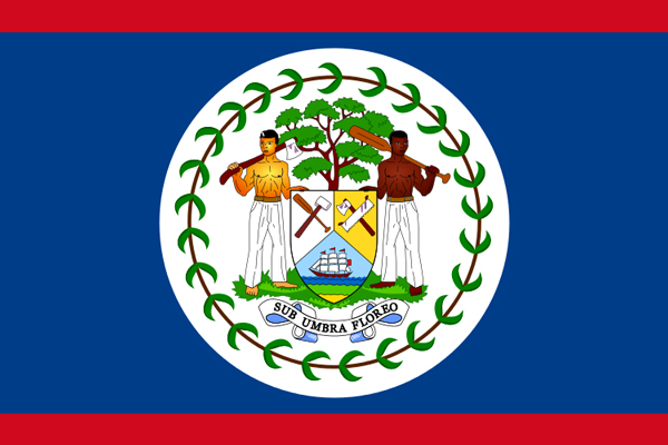
- Belize’s flag is the only national flag to depict human beings
- In 1638, the first European settlement was established in Belize by England
- Belize has a fairly consistent average yearly temperature of 84 degrees
- Belize has the smallest population in Central America
|
|
 |
|
The blue and red represent the colors of the country’s two main political parties. The elements of the coat of arms represent the logging industry that led to British settlement in Belize. The motto translates to “I Flourish in the Shade.” |
|