| |
Utah - the Beehive State |
| Click the points of the map below to learn more
|
| |
 |
Salt Lake City was founded by Brigham Young and members of the Church of Jesus Christ of Latter Day Saints (Mormons) in 1847. The Mormons were looking for an isolated place to practice their religious beliefs without being persecuted. Immediately, the settlers began building their temple, which was completed 40 years later. The settlers organized a new state, which they called Deseret. Congress denied their petition for statehood and instead created the Utah Territory. Salt Lake City was named capital of the territory in 1858.
Back to Map
|
| |
|
 |
St. George
St. George is the commerical center of the area known as
"Utah's Dixie". The area gained this nickname because Mormon farmers once grew cotton in the region ("Dixie" refes to areas of the southern United States). The area is also located at the lowest altitude in Utah, which makes summers very hot.
St. George was founded as a Mormon cotton mission. Under the direction of Brigham Young, the Mormons grew cotton in the hopes of becoming more self-sufficient. Although they did grow cotton, they failed to make a profit. Consequently, cotton production was abandoned.
Back to Map |
| |
|
 |
Ogden
Established in 1846 by fur trader Miles Goodyear, Ogden was the first permanent settlement by people of European descent in Utah. It was originally called Fort Buenaventura. Fort Buenaventura was purchased by Mormon settlers for $1,950 dollars. The area was renamed Ogden after a local fur trapper.
Today, Ogden is home to the George S. Eccles Dinosaur Park, a collection of over one hundred life-size, robotic dinosaurs that are based on actual fossils.
Back to Map |
| |
|
 |
Provo
Provo was founded in 1849 by Mormon settlers from Salt Lake City. It is the second largest city in Utah. The town was originally named Fort Utah, but changed to Provo in 1850. It was named after Étienne Provost, a French-
Canadian fur trapper who came to the region in the 1820's.
In 1875, Brigham Young Univeristy (BYU) was founded in Provo. Today, BYU is the largest Mormon university in
America, and maintains satellite campuses throughout the world. Over 34,000 students attend BYU.
Back to Map |
| |
|
 |
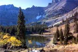
Monument Valley
Monument Valley is a spectacular region of the Colorado Plateau in southeastern Utah. It lies entirely within Navajo Indian tribal land.
The valley itself is an unearthly red color, almost reminiscent of images from Mars. The reddish color comes from iron oxide that has been exposed in the weathered siltstone.
The valley is punctuated by unusual rock formations and
towering mesas and buttes. A mesa is an elevated area of land with a flat top, and a butte is an isolated hill with steep sides and a small, flat top.
Back to Map |
| |
|
 |
Arches National Park
Arches National Park, located in eastern Utah, features more than 2,000 natural sandstone arches, including Delicate Arch, which is featured on the Utah license plate.
The olympic torch even passed through Delicate Arch in 2002.
The famous arches were formed from a sandstone layer deposited by an ancient sea. Over time, the salt underneath the sandstone forced it to rise and crack. The rising sandstone was exposed to wind, precipitation and erosion,
which resulted in the formation of the arches.
Back to Map |
| |
|
 |
Four Corners
Four Corners is an area of the American southwest, in
which the states of Utah, Colorado, Arizona, and New
Mexico all meet. Visitors can position themselves to be in
all four states at one time. It is the only place in America
where four states meet.
Back to Map |
| |
|
 |
Great Salt Lake
The Great Salt Lake is the largest saline (salty) lake in the western hemisphere, and fourth largest terminal lake in the world. A terminal lake is one in which there no is outflow of water.
The Great Salt Lake is a remnant of Lake Bonneville, a huge pre-historic lake that was at least ten times as large as the Great Salt Lake. The Great Salt Lake is far saltier than the ocean, and most people can easily float in the lake.
Back to Map |
| |
|
 |
Capitol Reef National Park
Capitol Reef National Park, located in central Utah, is one of five stunning national parks in Utah. Capitol Reef features buttes, canyons, ridges, and monoliths. It was named for a line of white domes and cliffs of sandstone that were thought to resemble the United States Capitol Building. The park is most famous because it encompasses
the Waterpocket Fold, a 65 million year-old wrinkle in the earth's crust.
Back to Map |
| |
|
 |
Colorado River
| Length: |
1,450 miles |
| Source: |
Rocky Mountain National Park |
| Outflow: |
Gulf of California |
| |
|
| The mighty Colorado River, which eventually flows through several national parks before carving the Grand Canyon, starts as a narrow stream near Lake Granby in Colorado's Rocky Mountain National Park. |
Back to Map |
| |
|
 |
Golden Spike
The Golden Spike was a ceremonial golden railway spike
hammered into the ground by Leland Stanford on May 10,
1869 in Promontory Summit, Utah.
The Golden Spike marked the completion of the world's first Transcontinental Railroad, as the Central Pacific and Union Pacific Railroads met. The completion of the Trans-continental Railroad allowed people to travel from coast to
coast in about seven days. Before the railroad, the same trip would have taken months.
Back to Map |
| |
|
 |
Canyonlands National Park
Canyonlands National Park, located in southern Utah, is one of five spectacular national parks in Utah. It features stunning and colorful landscapes of sandstone eroded into hundreds of buttes, canyons, and mesas by the Colorado and Green Rivers. Canyons carved by these rivers have resulted in the division of the park into three sections,
the Island in the Sky, the Needles, and the Maze.
Canyonlands also features petroglyphs and stone and mud dwellings from the ancient Puebloan people.
Back to Map |
| |
|
 |
Bryce Canyon National Park
Located in southwestern Utah, Bryce Canyon is actually not a canyon at all, but rather, a giant natural amphitheater created by the erosion along the eastern side of Paunsaugunt Plateau. The park has amazing geological features including hoodoos - tall, thin spires of rock that rise from the bottoms of arid basins or badlands (see
picture).
The park was named after Ebenezer Bryce, one of the
area's first settlers.
Back to Map |
| |
|
 |
Zion National Park
Zion National Park, located in southwestern Utah, features a dramatic landscape of towering cliffs and beautiful canyons. Zion is situated on the junction of three major geographical zones: the Colorado Plateau, Great Basin,
and Mojave Desert. The park's unusual geography supports a high level of biodiversity.
The name "Zion" is an ancient Hebrew word that translates to "sanctuary". Zion is by far, the most visited national park in Utah.
Back to Map |
| |
|
 |
Great Basin
Encompassing the entire state of Nevada, and much of Utah, Idaho, and Oregon, the Great Basin is an arid, mountainous area in the western United States, between the Rocky Mountains and the Sierra Nevada Range.
It consists of a series of mountain ranges in Nevada including the East Humboldt, Ruby, and White Mountains. The basin itself is a series of watersheds with no outlet to the sea or to a river that flows to the sea. Any precipitation that falls evaporates, seeps into the ground, or forms playas, short lived lakes that eventually evaporate.
Back to Map |
| |
|
 |
Colorado Plateau
The Colorado Plateau is a large 130,000 square-mile plateau centered on the Four Corners region of the American southwest. A plateau is a relatively flat area of high land. The semi-arid region features remarkable rock formation such as cliffs, arches, canyons, natural bridges and monoliths. Precipitation that falls in the area is drained to the sea by the Colorado River. The region is home to nine national parks including Grand Canyon, Arches, and Zion.
Back to Map
|
| |
|
 |
Mormon Trail
The Mormon Trail was a 1,300 mile path from Nauvoo, Illinois, to Salt Lake City Utah, used between 1846 and 1857 by members of the Church of Jesus Christ of Latter-day Saints (Mormons). Under the leadership of Brigham Young, the first group of Mormons set out from Nauvoo, to an undetermined destination somehwere in the Great Basin. Young hoped to find a place sufficently isolated and undesirable so that his people would not be bothered and could worship without persecution. When the settlers finally reached the Salt Lake Valley, Brigham Young is documented to have said , "This is the right place, drive on." Over the next 11 years, more than 13,000 Mormons poured into northern Utah.
Back to Map |
| |
|
 |
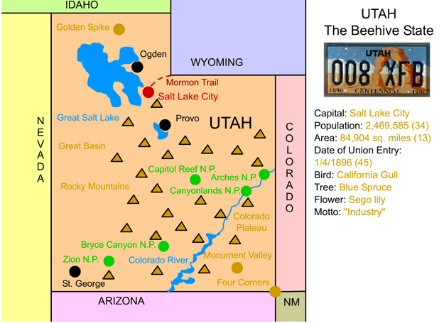
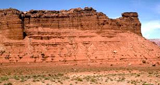
Rocky Mountains
The legendary Rocky Mountains extend through much of western North America from Canada to New Mexico. The "Rockies," as they are often called, stretch over
2,000 miles.
Highest Point:
|
Mt. Elbert (CO) 14,433 ft |
| Highest Point in Utah: |
Kings Peak (UT) 13,528 ft |
| |
|
Back to Map |
|
|
| |
| Top Five Facts |
| |
1. ) Utah is the only state where the majority of people are Mormons. |
2. ) Utah is also the only state to outlaw all forms of gambling. |
3. ) Utah has the youngest population of any state and the highest literacy rate among states. |
4. ) The Transcontinental raod was completed in Promontory Summit, Utah, on May 10, 1869. On that day, Leland Stanford hammered the "Golden Spike," which joined together the Union Pacific and Central Pacific Railroads. |
5. ) Salt Lake City is the largest city to host a Winter Olympics. |
| |
| Utah in History |
| |

|
1765: Juan Maria Antonio de Rivera of Spain, becomes the first European to visit Utah .
1776: Christian missionaries explored Utah, looking for a route to California.
1846: Ogden is founded by Miles Goodyear and marked the first permanent settlement by people of European descent in Utah.
1847: First Mormon settlers arrived in Utah under Brigham Young.
1847: Mormon settlers establish the town of Bountiful.
1848: United States gained control of Utah from Mexico after the Mexican War .
1849-1850: Mormon settlers petition the U.S. Government for statehood. At the time, the region was called Deseret and would have included much of the western United States. The petition was rejected.
1850: As a result of the Compromise of 1850, the Utah Territory was created.
1857: Mormon settlers and Paiute Indians massacre a group of immigrants from Arkansas in what came to be known as the Mountain Meadows Massacre. Control of the region passes between the Mormons and the U.S. Government repeatedly over the next decade.
1858: Salt Lake City is named capital of the Utah Territory.
1869: Transcontinental Railroad linking the Union Pacific and the Central Pacific was completed at Promontory Summit.
1896: Utah is admitted as the 45th state after Mormon leaders agree to ban the practice of polygamy (having multiple wives).
1906: Philo T. Farnsworth II, inventor of the television, was born in Beaver.
1919: Zion National Park is created.
2002: Salt Lake City hosts the 19th Winter Olympics.
|
|
|