 |
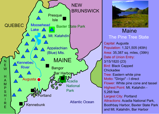
Portland is one of New England's most beautiful cities. It is also a popular tourist attraction for its lively nightlife and famous Portland Head Light, a symbol of the city's harbor. It is supposedly the most photographed lighthouse in the world. Portland is also known for its exceptional seafood, par-ticularly lobsters, for which the entire state is famous for.
Originally called Machigonne by the native people, and then
Falmouth by the British, Portland was destroyed in both King Phillip's War (1675) and the Revolutionary War (1775).
Back to Map
|
| |
|
 |
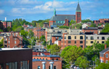
Mt. Katahdin
Mt. Katahdin is the highest point in Maine at 5,268 feet. It marks the northern terminus of the Appalachian Trail.
The name "Katahdin means "Great Mountain" in Penobscot language. Author Henry David Thoreau wrote about his ascent of Mount Katahdin in his book, The Maine Woods (1864).
Back to Map |
| |
|
 |
Presque Isle
Presque Isle is an isolated town located in the wilderness
of northern Maine. It is a popular vacation spot for outdoor
enthusiats.
Presque Isle was the takeoff point for the Double Eagle II, a
hot-air balloon that became the first balloon to cross the Atalntic Ocean when it landed in Paris, France, on August 17, 1978.
Back to Map |
| |
|
 |
Baxter State Park
Baxter State Park is a large state park in northern Maine that includes Mt. Katahdin, Maine's highest point. The park is one of Maine's most popular hiking and camping sites. Inside the park, there is no electricity, running water or paved roads. To keep the park wild, cellular telephones or radios are not allowed.
Back to Map |
| |
|
 |
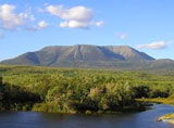
Bangor
Bangor, Maine was a major center for timber and logging in the 19th century. Many executives for major logging companies lived in huge Victorian homes that still exist today. Bangor was also the home of Hannibal Hamlin, Abraham Lincoln's vice president.
Today, Bangor is a lively town, home to a 175 year-old library, the Maine Discovery Museum, and the Mt. Hope Cemetery, the nation's second oldest garden cemetery.
Back to Map |
| |
|
 |
Augusta
Augusta, Maine was first explored by members of the Popham Colony in 1607. It was inhabited by individuals from the Plymouth Colony and built as a trading post in 1625. At the time, the settlement was known as Cushnoc. In 1754, Fort Western was built in the region. It is the oldest wooden fort still standing in the United States. Augusta was designated the capital of Maine in 1827. It was incorporated as a city in 1849.
Back to Map |
| |
|
 |
Acadia National Park
Acadia National Park, located on Mount Desert Island, features dramatic views of the Atlantic Ocean atop coastal cliffs and along Loop Road. The beautiful park was
originally called Sieur de Monts National Monument. It then
became Lafayette National Park, after the famous French soldier Marquis de Lafayette. Its name was changed to Acadia in 1929.
Today, many visitors to Acadia stay up all night near Cadillac Mountain to see the sunrise. It is one of the first places in the United States to see the sunrise each morning.
Back to Map |
| |
|
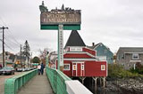 |
Kennebunkport
Kennebunkport is one of many small towns in coastal Maine that are popular tourist attractions and seaside resorts. Kennebunkport is best known as the summertime getaway of former president George W. Bush.
Back to Map |
| |
|
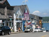 |
Bar Harbor
Bar Harbor is a beautiful coastal town located next to Acadia National Park. It is an extremely popular tourist attraction, and is known for its great shopping and roadside lobster vendors.
Originally known as Eden, it was incorporated as a town in 1796. It was originally a center for shipbuilding and logging. By the 1880's, however, the city had thirty hotels and had become a vacation getaway for millionnaires such as the Rockefellers and Astors. In 1918, the town's name was changed to Bar Harbor, in honor of Bar Island, a barrier island which protects the area from surging ocean waters.
In 1947, a severe drought led to a fire that burned most of the city and many of the elaborate Victorian mansions and hotels that lined its streets. Never-theless, the town was quickly re-built. Today, Martha Stewart and Julia Child are among celebrities known to spend summers in Bar Harbor.
Back to Map |
| |
|
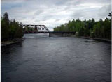 |
Kennebec River
| Length: |
150 miles |
| Source: |
Moosehead Lake |
| Outflow: |
Atlantic Ocean |
| |
|
The Kennebec River is perhaps the most historically significant river in Maine. It was explored by French explorer Samuel de Champlain from 1604-1605. It was also the site of the 1607 Popham Colony, the first English settlement in New England. The settlement was located at present day Phillipsburg, at the mouth of the Kennebec River. The colony, however was ultimately unsuccessful
and was abandoned in 1608. |
Back to Map |
| |
|
 |
Moosehead Lake
| Length: |
40 miles |
| Shoreline: |
400 miles |
Moosehead Lake is the largest lake in Maine and second largest lake east of the Mississippi River fully within the borders of one state.
Back to Map |
 |
Appalachian Mountains
The Appalachians extend nearly 1,500 miles from Canada to Georgia. They are known as the Blue Mountains in Maine.
Highest Point:
|
Mt. Mitchell (NC) 6,684 ft |
| Highest Point in Maine: |
Mt. Katahdin: 5,268 ft |
| |
|
Back to Map |