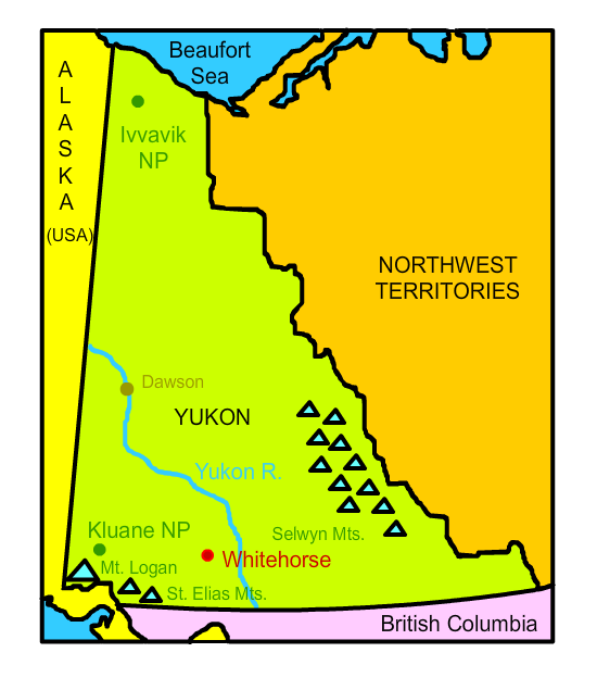
Click on the map below to learn more
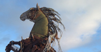 |
WhitehorseWhitehorse is the capital and largest city of Yukon. It has a population of about 25,000 residents and is the largest city in northern Canada. It was named for the powerful rapids of the Yukon River which were said to resemble the flowing manes of charging white mustangs. The city became a staging area for "stampeders" in the Klondike Gold Rush of 1897. These stampeders found copper in the hills west of Whitehorse, which resulted in a copper rush. Whitehorse remained an isolated town until World War II, when American soldiers built the Alaska Highway through Whitehorse, making it an important center of transportation and communication through northern Canada. In 1953, the capital of Yukon was moved from Dawson City to Whitehorse. Despite an average temperature of -2.6 degrees Fahrenheit in January, Whitehorse is the warmest place in the Yukon. It is also the driest place in Yukon, receiving an average of 57 inches of snow in the winter and 6.4 inches of rain in the summer.
|
|
| Back to Map | ||
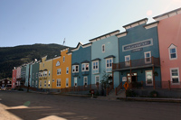 |
DawsonWith a population of less than 1,500, Dawson (also called Dawson City) is actually a town rather than a city. It is Yukon's second largest population region. Dawson was the capital of Yukon from 1898 until 1952, when Whitehorse became capital. Dawson's history began with the 1896 Klondike Gold Rush. More than 100,000 people came to the area when gold was discovered by local miners. While some "stampeders" in deed became wealthy, the vast majority left empty handed. During this time, Dawson became a lawless, unsanitary boomtown that was plagued with fire, disease, and illegal activity. At its peak, nearly 40,000 people were thought to have taken up residence in Dawson City. Following the gold rush, however, most of the population abandoned it and by 1902, less than 5,000 people remained. The population declined even more after World War II, when the Alaska Highway was built through Whitehorse rather than Dawson. Today, gold mining remains Yukon's most important industry. |
|
| Back to Map | ||
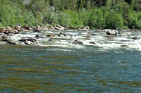 |
Yukon RiverThe Yukon River is a major river that rises in British Columbia and flows through Yukon and Alaska and into the Bering Sea. Its course extends 1,982 miles. The river is home to one of the world's longest salmon runs. Recently, however, the number of salmon have declined dramatically. |
|
| Back to Map | ||
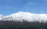 |
Mt. LoganLocated in the St. Elias Mountains, Mt. Logan is the highest peak in Yukon and the highest peak in all of Canada. Rising to a height of 19,551 feet, Mt. Logan is the second highest peak in North America, trailing only Denali in Alaska. Because of tectonic uplifting, Mt. Logan is thought to be rising higher. |
|
| Back to Map | ||
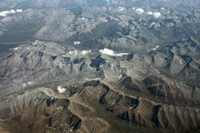 |
Selwyn MountainsThe Selwyn Mountains are a mountain range in eastern Yukon and western Northwest Territories. Some scientists consider the range the northern limit of the Rocky Mountains. At 9,751 feet, Keele Peak is the highest point in the Selwyns. These mountains were named after Alfred Richard Cecil Selwyn, director of the Geological Survey of Canada from 1869 to 1894. |
|
| Back to Map | ||
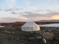 |
Ivvavik National ParkOriginally called Northern Yukon National Park, its name was changed to the Inuit word "Ivvavik" in 1992. The name means "nursery" or "birthplace" for caribou calves. The park was the first national park in Canada to be created as an aboriginal land claims agreement between the Inuit first nation and the Canadian government. The park contains important Inuit cultural sites and abundant wildlife. Grizzly bears, black bears, wolves, moose, snowy owls, and gyrfalcons, are among the wildlife found in the park. Because of the area's importance as a caribou calving ground, very few visitors are permitted within park boundaries.
|
|
| Back to Map | ||
 |
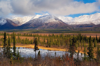
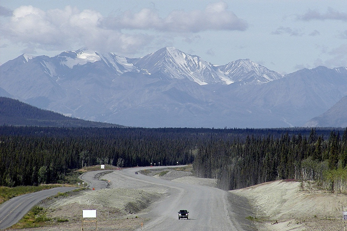
Kluane National ParkCovering an area of about 8,500 square miles, Kluane National Park is situated just across the Alaska border, in the St. Elias Mountains. 83 percent of the park is covered by high mountains and glaciers. Canada's highest peak, Mt. Logan, is also situated within the park. Kluane is also home to Canada's largest ice field, and the continent's most genetically diverse population of grizzly bears. |
|
| Back to Map | ||
 |
St. Elias MountainsThe St. Elias Mountains are a subgroup of the Coast Range. They are located in southern Alaska, Yukon, and western British Columbia. The high, rugged, snow-capped peaks are among the highest in the continent and represent the highest coastal range on Earth. The range features 13 mountains over 15,000 feet, and 17 mountains higher than the highest peak in the continental United States. Yukon's Mt. Logan, the highest point in the range, rises to an altitude of 19,550 feet - the tallest peak in Canada and second-tallest peak in North America. |
|
| Back to Map | ||
 |
||
| Kluane National Park | ||
| Population: | 40,408 | |
| Area: | 186,282 sq. miles | |
| Capital City: | Whitehorse | |
| Largest City: | Whitehorse | |
| Currency: | Canadian Dollar | |
| Official Language: | English | |
| GDP (Gross Domestic Product) | $2.66 billion | |
|
||
 |
||
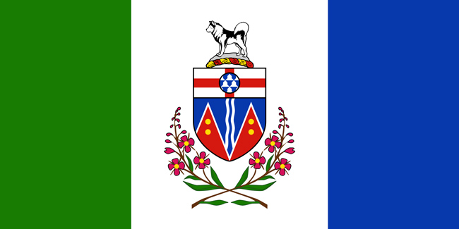
| The green in the flag represents Yukon's forests, the white represents snow, and the blue represents Yukon's lakes and rivers. The Yukon coat of arms is in the center of the flag. The coat of arms features various symbols of Yukon such as the malamute, a working dog common to Yukon, and fireweed, Yukon's provincial flower. St. George's Cross at the top of the coat of arms represents the province's connection to England, and the red peaks at the bottom represent Yukon's mountainous landscape. The gold circles within the mountains represent Yukon's mineral resources. | ||