Click on the map below to learn more
 |
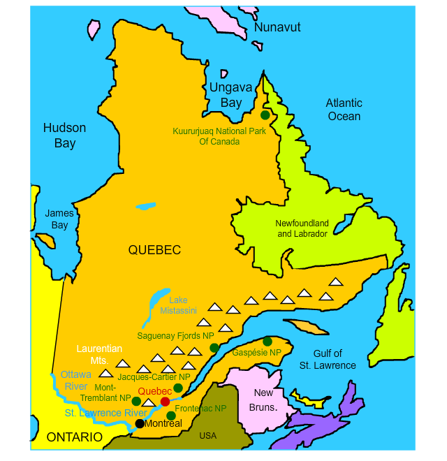
MontrealMontreal is the largest city in Quebec and the second-largest city in all of Canada. It is named for Mount Royal, a hill with three peaks in the heart of the city. Over four million people live in and around Montreal, 65 percent of which speak French. Montreal is the world's second largest French-speaking city, trailing only Paris, France. Montreal is an important center of commerce, culture, film, and tourism. In 1976, Montreal became the only Canadian city to host the summer Olympics. In 1535, French explorer Jacques Cartier explored the region. At the time, it was an important Iroquois village named Hochelaga. Cartier believed the famed Northwest Passage lay just beyond the village. In 1642, a fortress called Villa Marie was built in modern-day Montreal and quickly became an important center for the bustling fur trade. Following the French and Indian War and the American Revolution, Montreal was incorporated as a city in 1832 with the opening of the Lachine Canal.
|
|
| Back to Map | ||
 |
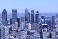
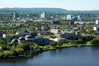
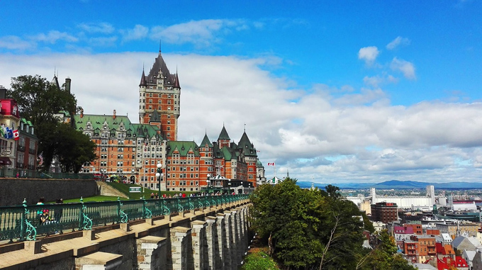
QuebecQuebec, or Quebec City, is the capital and second-largest city in Quebec. The city was originally called Kèbec by the Algonquin people, which means "place where the river narrows." Founded by French explorer Samuel de Champlain in 1608, it is the oldest permanent French settlement in the New World. The ramparts surrounding the city make it North America's only fortified city north of Mexico. In 1985, the entire city was named a UNESCO World Heritage site. Quebec City was the site of three battles in the French and Indian War, including the Battle of the Plains of Abraham in 1759. The British victory here virtually guaranteed their victory in the entire war and France's fall from the New World. The city skyline is dominated by Château Frontenac (pictured), a 262-foot tall hotel originally built by the Canadian Pacific Railway. The hotel was one of a series of "grand railway hotels" across Canada built by the railway company.
|
|
| Back to Map | ||
 |
St. Lawrence RiverFlowing for a length of about 743 miles, the St. Lawrence River connects the Great Lakes to the Atlantic Ocean. It flows into the Gulf of St. Lawrence, which is the largest estuary in the world. The upper parts of the St. Lawrence River are home to a region known as Thousand Islands. There are actually 1,864 islands. One of the criteria of each "island" is that is supports at least two living trees! |
|
| Back to Map | ||
 |
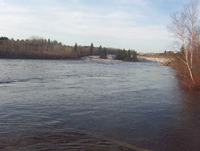
Ottawa RiverThe Ottawa River is a major tributary of the St. Lawrence River and forms most of the border between Ontario and Quebec. It flows for a distance of about 790 miles. |
|
| Back to Map | ||
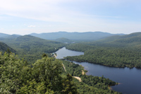 |
Mont-Tremblant National ParkMont-Tremblant National Park is Canada's second-largest provincial park. It is named after Mont-Tremblant, which is a city in Quebec famous for its ski resorts and for car racing. The area was originally called "Manitonga Soutana" by the Algonquin people. The name means "Mountain of Spirits or the Devil." According to Algonquin legend, the mountains made rumbling noises and swayed under their feet. Today, the park is a popular skiing, canoeing, and kayaking destination. Its boreal forests and clear lakes provide habitat for numerous breeding birds including loons, eagles, and tiny warblers. |
|
| Back to Map | ||
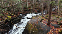 |
Jacques Cartier National ParkLocated about 50 miles north of Quebec City, Jacques Cartier National Park is named after the French explorer who first sailed down the St. Lawrence River, searching for the Northwest Passage. The park's mission is to protect the pristine boreal forests of the Laurentian mountains and the Jacques-Cartier Valley. |
|
| Back to Map | ||
 |
Laurentian MountainsThe Laurentian Range is a small group of mountains located in southern Quebec. Among the oldest mountains in the world, the Laurentians are thought to have been born during a period of mountain eruption known as the Grenville Orogeny, about a billion years ago. Eroded over millions of years, the highest point in the range is Mont Raoul Blanchard, which rises to a height of 3,825 feet (1,166 meters). |
|
| Back to Map | ||
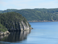 |
Saguenay Fjords National ParkCreated in 1983, Saguenay Fjords National Park protects Quebec's beautiful Saguenay Fjord. A fjord is a long, narrow inlet of the sea surrounded by cliffs. The cliffs along the Saguenay River can rise to heights over 500 feet. The park also contains boreal forests, lakes, and provides habitat for numerous species of birds, fish, and mammals, including four species of whales. The subpopulation of beluga whales that exist in the region are now considered endangered because the polluted waters. |
|
| Back to Map | ||
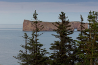 |
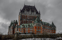
Gaspèsie National ParkLocated on Quebec's Gaspè Peninsula, Gaspèsie National Park lies between the Chic-Choc and McGerrigle Mountains (each part of the larger Laurentian Range). Gaspèsie National Park is home to the highest peak in the Laurentians, Mont Raoul Blanchard. The park was created in 1937 to protect the area's caribou population, which represent the southernmost population in the world. Today the park is a very popular hiking, canoeing, and biking destination. Because of its altitude and proximity to the coast, the park is one of the wettest regions in Quebec. |
|
| Back to Map | ||
 |
Lake MistassiniLocated in central Quebec, Lake Mistassini is the largest lake in Quebec. Lake Mistassini is notable for its unusual, arc-like shape. Some scientists believe the lake was formed by a meteor strike over two billion years ago. The lake measures about 100 miles in length, and 12 miles at its widest. Its maximum depth is about 600 feet. |
|
| Back to Map | ||
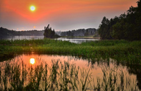 |
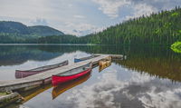
Frontenac National ParkFrontenac National Park features a dazzling environment of boreal forest, crystal lakes, bogs, and other wetlands. Established in 1987, its mission was to protect Grand Lac Saint-François and its important walleye fisheries from invasive plants and recreational boating. In addition, over 200 species of birds and 30 species of mammals have been identified within the park borders. |
|
| Back to Map | ||
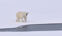 |
Kuururjuaq National ParkKuururjuaq National Park is located in extreme northeastern Quebec. It stretches for over 1,720 square miles from Ungava Bay to Mont D'Iberville, the highest peak in eastern Canada. Developed and maintained by the Inuit Nation, the park preserves a portion of the Torngat Mountains. It features an arctic landscape full of polar bears, black bears, caribou, snowy owls, and other arctic wildlife. |
|
| Back to Map | ||
 |
||
| Frontenac Castle - Quebec City | ||
| Population: | 8,452,000 | |
| Area: | 595,391 sq. miles | |
| Capital City: | Quebec | |
| Largest City: | Montreal | |
| Currency: | Canadian Dollar | |
| Official Language: | French | |
| GDP (Gross Domestic Product) | $381 Billion | |
|
||
 |
||
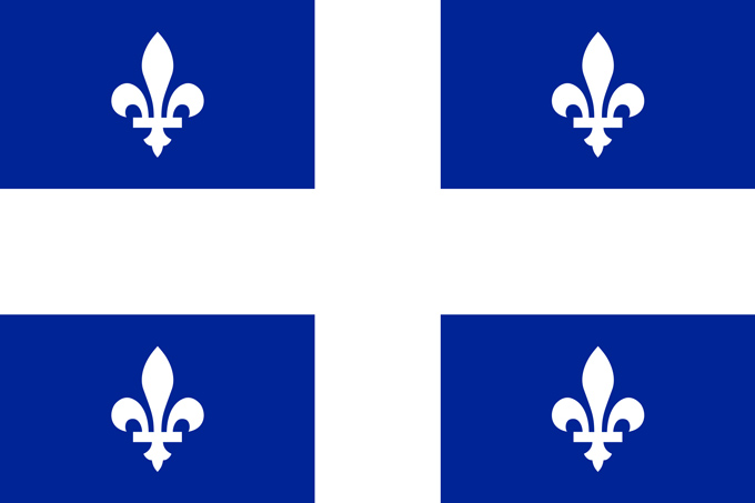
| Adopted in 1950, Quebec's flag was the first provincial flag. The flag features four identical designs known as fluers-de-lis. These symbols represent purity. The blue in the flag represents heaven. The white cross comes from the ancient royal flags of France. | ||