Click on the map below to learn more
 |
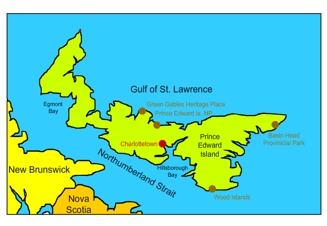
CharlottetownCharlottetown is the capital and largest city in Prince Edward Island. The town was named after queen consort Charlotte, wife of King George III. During the French and Indian War in 1758, the British took control of the region and built Fort Amherst near modern-day Charlottetown. In 1864, Charlottetown hosted the Charlottetown Convention, which lead to the establishment of the Canadian Confederation. It was during this conference that the maritime provinces of Canada were made part of Canada. Interestingly, during the conference, a circus was in town that was much more interesting to the local citizens. Today, Charlottetown is a popular tourist attraction for its beautiful Victorian-era homes and its maritime culture. It is a frequent stop for cruise ships touring the Gulf of St. Lawrence and St. Lawrence River.
|
|
| Back to Map | ||
 |
Green Gables Heritage PlaceGreen Gables Heritage Site was established to honor Anne of Green Gables, one of the most beloved of Canada's fictional characters. The story, written by Prince Edward Island native Lucy Maud Montgomery in 1908, details the life of an orphan girl who is mistakenly brought to Avonlea to work on a farm owned by elderly siblings. Visitors can tour Anne's Avonlea (Anne's House) in its beautiful setting of rolling farmlands and sandy beaches. |
|
| Back to Map | ||
 |
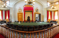
Prince Edward Island National ParkFounded in 1937, Prince Edward Island National Park features pristine beaches, sand dunes, and wetlands. It provides critical habitat to the endangered piping plovers as well as other shorebirds. The park also includes Green Gables, which was the childhood inspiration for the famous novel Anne of Green Gables.
|
|
| Back to Map | ||
 |
Basin Head Provincial ParkNicknamed "singing sands," Basin Head Provincial Park features beautiful white-sand beaches. The sand appears white due to its high concentration of silica. When beachgoers walk the beaches, and the sun heats up the sand, it produces a squeaking noise. Those who drag their feet through the sand can hence produce the "singing sand." In addition, Basin Head Provincial Park is the only place in the world that has Giant Irish Moss. Giant Irish Moss is unusual in that it is not anchored to the ground, and thus can only reproduce by cloning itself. It is larger than typical Irish moss and has a higher concentration of carrageenan, which is used as a thickening agent in many products. |
|
| Back to Map | ||
 |
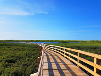
Wood IslandsWood Islands is a small fishing community located in Prince Edward Island. It is most famous for being the home of the Wood Islands Lighthouse, one of Canada's most historic and well-known lighthouses. Today, the Wood Islands Lighthouse features a lighthouse museum and allows visitors to tour the lighthouse and even visit the built-in living quarters and kitchen of the former lighthouse keeper. |
|
| Back to Map | ||
 |
||
| Wood Islands | ||
| Population: | 155,318 | |
| Area: | 2,190 sq. miles | |
| Capital City: | Charlottetown | |
| Largest City: | Charlottetown | |
| Currency: | Canadian Dollar | |
| Official Language: | English | |
| GDP (Gross Domestic Product) | $5.35 Billion | |
|
||
 |
||
| Like several of Canada's maritime provinces, the flag of Prince Edward Island is heavily influenced by English symbolism. The lion on top of the flag was similar to the lion that appeared on the coat of arms of Prince Edward himself (Duke of Kent) and that of King Edward VII. The saplings on the island at the bottom of the flag represent the three counties of Prince Edward Island under the protection of the large oak tree, which represents Great Britain. The island itself represents that both Prince Edward Island and Gret Britain are islands. | ||