Click on the map below to learn more
 |
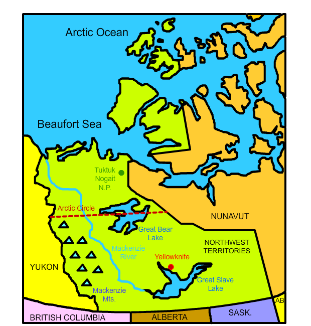
YellowknifeLocated on the northern shores of the Great slave Lake, Yellowknife is the largest city and capital of the Northwest Territories. In fact, with a population of about 20,000 people, Yellowknife is the ONLY city in the vast province. The city gets its name from the local Dene people who made tools from nearby copper deposits and were hence referred to as "Yellowknife Indians" or "Copper Indians." For most of its history, Yellowknife has been a staging area for various mining operations, including several gold mines. The last gold mine near the city, however, closed in 2004. In 1991, diamonds were discovered near Yellowknife, renewing interest in the region and now serving as its top industry.
|
| Back to Map | |
 |
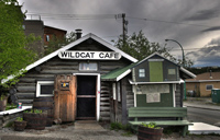
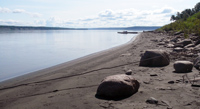
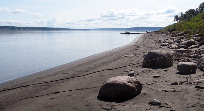
Great Slave LakeThe Great Slave Lake is the tenth largest lake in the world and the deepest lake in North America. It covers an area of more than 10,000 square miles. It is over 2,000 feet deep at its deepest. The name "Great Slave" is derived from a Cree translation of people they named "slavey." The Cree and Slavey peoples were bitter enemies and captives were made into slaves. French fur traders in the region called the lake Grand Lac des Escalves which in English means Great Slave Lake. |
| Back to Map | |
 |
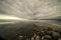
Great Bear LakeThe massive Great Bear Lake is the largest lake entirely in Canada and the eighth largest lake in the world. It covers an area of just over 12,000 square miles. The name is derived from a Chipewyan word meaning "grizzly bear water people." It is a deep lake with a maximum depth of 1,463 feet. Great Bear Lake is sacred to the native Sahtu Dene people, who consider it the giant, beating heart of humanity. The lake is rarely free of ice at any time during the year, but in July and August, fisherman from around the world visit the lake to take advantage of what many believe is the world's greatest lake trout fishery. |
| Back to Map | |
 |
Mackenzie RiverThe Mackenzie River system, which flows through the Northwestern Territories of Canada, is the longest river system in Canada and the 13th longest in the world. The river itself flows for 1,080 miles, but the system, which includes its tributaries, flows for 2,635 miles. The Mackenzie River flows from Great Slave Lake all the way into the Arctic Ocean. It is the longest North American river that flows into the Arctic Ocean. |
| Back to Map | |
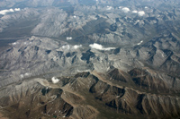 |
Mackenzie MountainsThe Mackenzie Mountains are a mountain range that forms part of the border between the Northwest Territories and Yukon in western Canada. They merge with the Selwyn Mountains in Yukon. The range was named after Canadian explorer and second prime minister Alexander Mackenzie. The Mackenzie Mountains are located in an extremely remote part of Canada. There are only two roads that lead in and out of the range. Keele Peak, which rises to 9,751 feet is the highest mountain in the range. |
| Back to Map | |
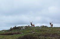 |
Tuktuk Nogait National ParkLocated in one of the most remote corners of Canada, Tuktuk Nogait National Park is an important calving grounds for caribou. It is located 170 miles north of the Arctic Circle in the barren Arctic tundra. Three rivers flow through the massive park, which is completely devoid of trees. The park is also home to grizzly bears, wolverines, wolves, musk oxen, gyrfalcons, and golden eagles, among others, besides caribou. |
| Back to Map | |
 |
|
| Mackenzie River | |
| Population: | 44,400 |
| Area: | 519,734 sq. miles |
| Capital City: | Yellowknife |
| Largest City: | Yellowknife |
| Currency: | Canadian Dollar |
| Official Language: | English; French; and several native languages |
| GDP (Gross Domestic Product) | $5 billion |
|
|
 |
|
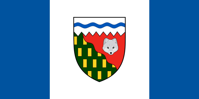
| The blue in the flag represents the territory's lakes and rivers, while the white represents snow. The Northwest Territory's coat of arms is in the center of the flag. In the coat of arms, the white top with the wavy blue line represents the Arctic Ocean and Northwest Passage. The diagonal line represents the tree line. The red part of the shield represents the Arctic tundra, and the fox represents the region's valuable fur trade. The green in the shield represents forests and the golden rectangles represent the province's mineral resources. | |