Click on the map below to learn more
 |
Mt. CarletonMt. Carleton is part of New Brunswick's Mt. Carleton Provincial Park. Mt. Carleton, rising to a height of 2,690 feet (817 meters) is the highest peak in New Brunswick. The mountain was named after Thomas Carleton - New Brunswick's first provincial governor. Mt. Carleton is a monadnock - the remains of igneous rock that has suffered erosion over the period of many millions of years. |
| Back to Map | |
 |
Notre Dame MountainsThe Notre Dame Mountains are a portion of the Appalachian Range that rise northeast to southwest through parts of Vermont, Quebec, and New Brunswick. The range, which runs approximately 500 miles, was named by French explorer Samuel de Champlain. These mountains are extremely old and have been eroded severely over hundreds of millions of years. The average height of peaks within the range averages only about 2,000 feet (600 meters). |
| Back to Map | |
 |
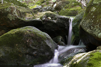
Saint John RiverThe St. John River flows winds apx. 418 miles (673 km) from central Maine, through Quebec and New Brunswick, before emptying into the Bay of Fundy. The river forms much of the border between the state of Maine and the province of New Brunswick. The river was named by French explorer Samuel de Champlain, who visited the mouth of the river on the Nativity of John the Baptist in 1604. Hence, the river was named Rivière Saint-Jean, French for St. John River. |
| Back to Map | |
 |
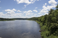
FrederictonWith a population of about 57,000, Fredericton is the capital and third-largest city of New Brunswick. Fredericton was the colonial center of the region known as Acadia. Acadia was a colony of New France located in Maine and parts of Maritime Canada. The Acadian descendents of these original colonists would eventually relocate to Louisiana after being forcibly removed from the region by the British after the French and Indian War. Today, Fredericton is the cultural, educational, and artistic center of New Brunswick. It is the home of numerous art galleries, art festivals, and film festivals and the birthplace of several of Canada's most prominent poets and writers. |
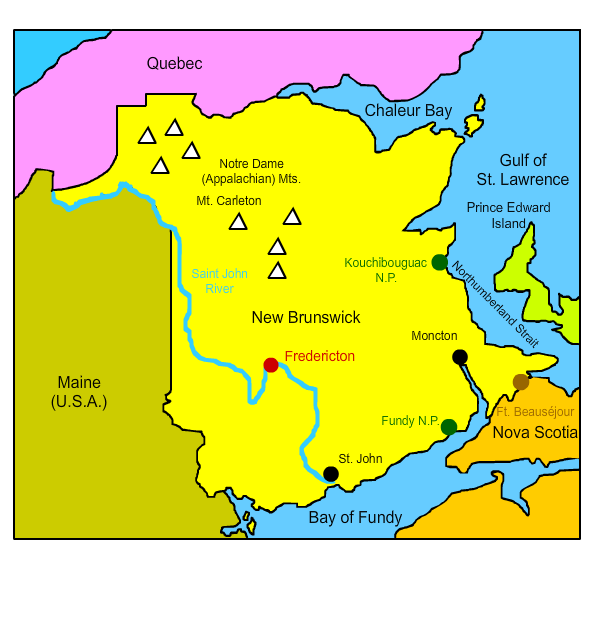
| Waterfalls at Fundy National Park | |
| Back to Map | |
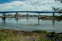 |
Saint JohnSt. John is a major port city located on the shores of the Bay of Fundy in southern New Brunswick. With a population of about 68,000, it is the second largest city in the province. St. John is the oldest incorporated city in Canada. It was founded by French explorer Samuel de Champlain who named the settlement and river after John the Baptist. The settlement grew quickly during the American Revolution War when American Loyalists (those loyal to England) fled Massachusetts after being forced from their homes. St. John has long been a shipbuilding center and features one of the world's largest dry docks. A dry dock is a dock that can be drained of its water so the hulls of ships can be inspected and repaired. In recent years, tourism has played a more important role in the local economy. St. John hosts over 1.5 million visitors per year, many of whom come from cruise ships. St. John also features numerous art galleries and is the home of the Moosehead Beer brewery. |
| Back to Map | |
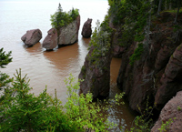 |
Fundy National ParkSpectacular Fundy National Park, located along the New Brunswick shoreline, features some of the highest tides on Earth. The difference between low and high tides within the park can be as great at 38 feet (12 meters). At low tide, visitors to the park can actually walk on the sea floor. In addition, the park features more than 25 waterfalls and pristine acadian forests. Fundy National Park is part of a series of dark sky preserves in New Brunswick. This means that electric lights at night are restricted, allowing for incredible stargazing. |
| Back to Map | |
 |
MonctonWith a population of about 72,000, Moncton is the largest city in New Brunswick. Because of its central location within the Canadian maritime provinces, and because of its history as a railway and transportation hub, it is sometimes referred to as "hub city." Moncton was founded in 1766 by Pennsylvania Dutch settlers. It was named after Robert Monckton, a British officer who helped to capture nearby Ft. Beausèjour in the French and Indian War. For much of its early history, Moncton was an important center of shipbuilding. When the shipbuilding industry collapsed, it served as the railway center for the Intercolonial Railway of Canada and the Canadian National Railway. In 2002, Moncton became Canada's first officially bilingual city. |
| Back to Map | |
 |
Fort BeausèjourThe Battle of Fort Beausejour occurred between June 3 and June 16, 1755. It was one of the first battles of the French and Indian War. 2,000 British soldiers under the command of Robert Mockton besieged the fort on June 3. British forces hoped to capture Fort Beausejour to gain control of the nearby Isthmus of Chignecto, which connects the peninsula of Nova Scotia with the rest of North America. French defensive forces, numbering only 162, withstood the siege and bombardment for thirteen days before surrendering on June 16. |
| Back to Map | |
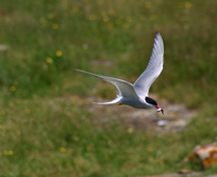 |
Kouchibouguac National ParkThe pristine barrier islands and sand dunes of Kouchibouguac National Park provide refuge for the endangered piping plover and habitat for the continent's second largest colony of common terns. The park also features lagoons, salt marshes, and forests. The park is named after the Kouchibouguac River. The word Kouchibouguac means "river of the long tides" in native language. Creation of Kouchibouguac National Park in 1969 was controversial and required the eviction of over 1200 Acadian people from seven different communities. Several documentaries have been filmed regarding the creation of the park and the forced eviction of the people from their ancestral land. |
| Back to Map | |
| Population: | 747,000 |
| Area: | 28,150 sq. miles |
| Capital City: | Fredericton |
| Largest City: | Moncton |
| Currency: | Canadian Dollar |
| Official Language: | English/French |
| GDP (Gross Domestic Product) | $32.180 Billion |
|
|
 |
|
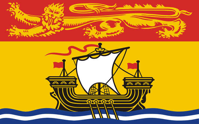
| The New Brunswick flag was adopted in 1965. The ship represents the importance of the shipbuilding industry in New Brunswick's history. The white and blue waves on the bottom of the flag represents the ocean. The lion on the top part of the flag represents New Brunswick's connection to England. | |