Click on the map below to learn more
 |
VancouverNamed after British explorer George Vancouver, Vancouver is the third largest city in Canada, the largest city in British Columbia and western Canada, and one of the most cosmopolitan cities in the world. Originally a staging area for the Klondike Gold Rush and later as a major logging center called Gastown, Vancouver grew quickly as the western terminus of the Canadian Pacific Railway. Today, it is the cultural and economic engine of western Canada and is home to the TED Corporation, 1-800-Got-Junk, the third largest port in North America, and one of the continent’s largest center of film production. In fact, it is often called "Hollywood North." Although forestry remains Vancouver's top industry, tourism is now its secondmost important industry. Vancouver is one of Canada’s most visited city and hosted the 2010 Winter Olympics. It is home to the NHL’s Vancouver Canucks. Vancouver’s Stanley Park is one of the worlds most famous urban parks.
|
||||||||
| Back to Map | |||||||||
 |
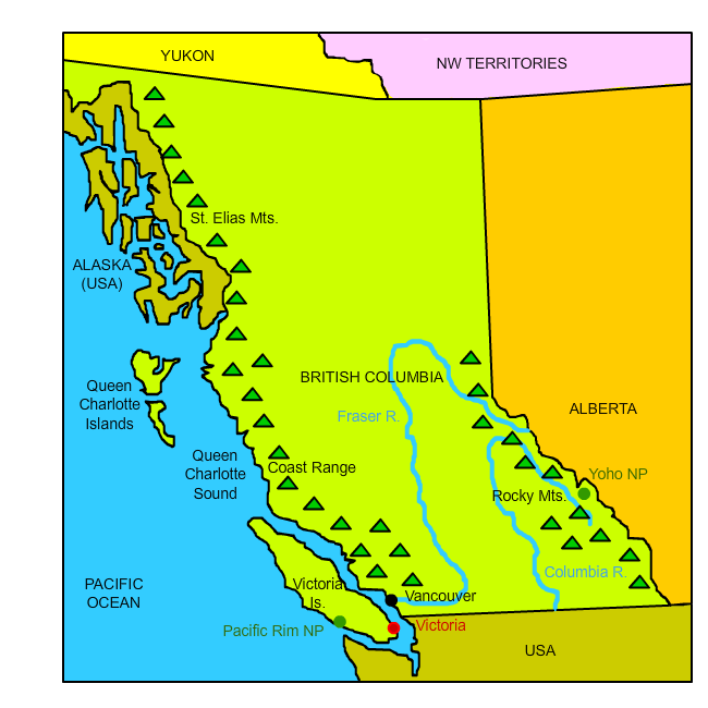
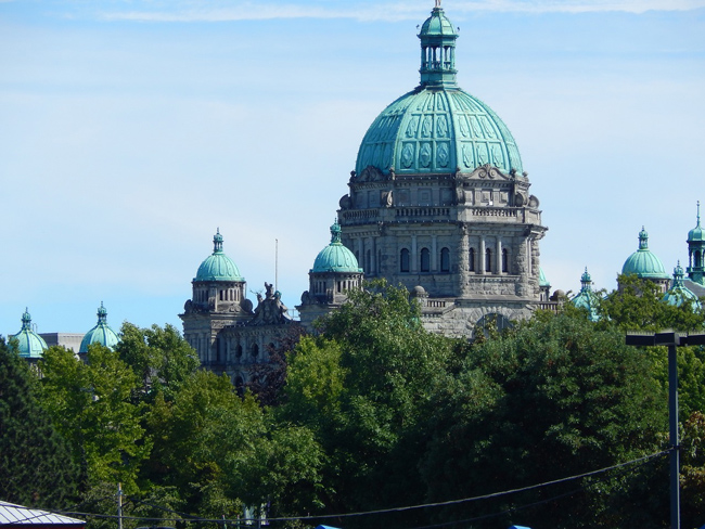
VictoriaVictoria is the capital and second largest city British Columbia. It is the southermost major city in British Columbia. Named after Queen Victoria in 1843, the city of Victoria is one of the oldest cities in the Pacific Northwest. Nicknamed "the Garden City," Victoria has become a popular tourist destination. The city is home to world-class attractions such as Butchart Gardens - an incredible group of illuminated floral displays, statues, water features, and totem poles that attract over a million visitors each year. It also home to the Empress Hotel, one of the Canadian Pacific Railway's grand railway hotels built in 1908. In addition, Victoria is home to the continent's second largest Chinatown. Only San Francisco's is larger. |
||||||||
| Back to Map | |||||||||
 |
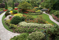
Queen Charlotte Islands (Haida Gwaii)Also known as Haida Gwaii, the Queen Charlotte Islands occupy a total land area of about 4,000 square miles. The islands were the heart of Haida People, who have occupied them for over 13,000 years. The Haida people currently make up more than 1/2 of the population of the islands and exercise sovereignty over the islands through their government, the Council of the Haida Nations. The Haida Nation is known for its construction of both totem poles and canoes. Known as the "Vikings of the North," Haida canoes were constructed out of a single red cedar tree and could carry 60 warriors over open ocean to raid neighboring groups. Such canoes were ornately painted with designs and murals.
|
||||||||
| Back to Map | |||||||||
 |
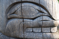
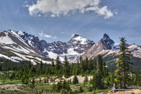
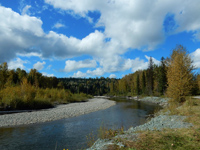
Yoho National ParkYoho National Park is located in the Rocky Mountains in eastern British Columbia. The word "Yoho" is Cree for "amazement." Yoho features some of the highest mountains in the Canada Rockies, as well as icefields, waterfalls, and lakes. Yoho National Park was created in 1886, making it the second oldest park in the Canadian National Park system.
|
||||||||
| Back to Map | |||||||||
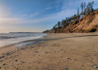 |
Pacific Rim National ParkPacific Rim National Park is located on the west coast of Victoria Island. The Pacific Rim comprises the west coasts of North and South America and much of the east coast of Asia and is characterized by heavy volcanic activity. Pacific Rim National Park is actually divided into three sections, each with a different theme. Long Beach is where surfers and windboarders visit, Broken Islands is for kayakers, and the West Coast Trail is for hiking and scuba diving (in some parts). The park itself features a small portion of the towering Coast Range along with lush, temperate rainforests.
|
||||||||
| Back to Map | |||||||||
 |
Coast RangeThe Coast Range is the westernmost range of a series of ranges that run along the west coast of North America known as the Pacific Cordillera.
|
||||||||
| Back to Map | |||||||||
 |
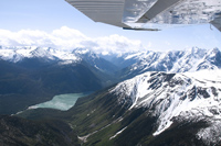
Rocky MountainsThe legendary Rocky Mountains extend through much of western North America from Canada to New Mexico. The "Rockies," as they are often called, stretch over
|
||||||||
| Back to Map | |||||||||
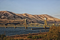 |
Columbia RiverBeginning in British Columbia, the mighty Columbia River flows through Washington State and forms the border between that state and Oregon. It then flows west, merging with the Willamette River, before flowing into the Pacific Ocean. The Columbia River is the largest river (in volume) flowing into the Pacific Ocean from the Western Hemisphere. It is the largest hydroelectric power producing river in North America.
|
||||||||
| Back to Map | |||||||||
 |
Fraser RiverThe Fraser River is the longest river entirely within British Columbia. It is named after Simon Fraser, an explorer who traveled the river in 1808.
|
||||||||
| Back to Map | |||||||||
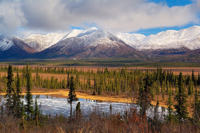 |
St. Elias MountainsThe St. Elias Mountains are a subgroup of the Coast Range. They are located in southern Alaska, Yukon, and western British Columbia. The high, rugged, snow-capped peaks are among the highest in the continent and represent the highest coastal range on Earth. The range features 13 mountains over 15,000 feet, and 17 mountains higher than the highest peak in the continental United States. Yukon's Mt. Logan, the highest point in the range, rises to an altitude of 19,550 feet - the tallest peak in Canada and second-tallest peak in North America. |
||||||||
| Back to Map | |||||||||
 |
|||||||||
| Victoria | |||||||||
| Population: | 4,648,000 | ||||||||
| Area: | 364,764 sq. miles | ||||||||
| Capital City: | Victoria | ||||||||
| Largest City: | Vancouver | ||||||||
| Currency: | Canadian Dollar | ||||||||
| Official Language: | English | ||||||||
| GDP (Gross Domestic Product) | $250 Billion | ||||||||
|
|||||||||
 |
|||||||||
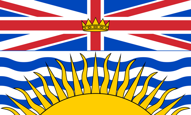
| The Royal Union Flag is on the top of the flag. It reflects the province’s British heritage. The King Edward Crown in the middle of the flag represents the Royal Family. The lower half of the flag features a setting sun, which symbolizes British Columbia's location in western Canada. The blue and white lines behind the sun symbolize its location between the Rocky Mountains and Pacific Ocean. | |||||||||