Click on the map below to learn more
 |
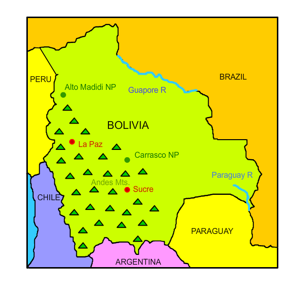
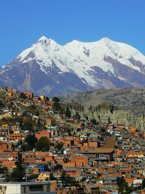
La PazLa Paz is Bolivia’s administrative capital and the world’s highest national capital, located between 10,650 and 13,250 feet above sea level. Due to the height of the city, visitors can sometimes experience challenges initially adjusting to the atmosphere and air pressure levels.The city was founded by a conquistador in 1548 with the name “Nuestra Senora de La Paz,” meaning Our Lady of Peace. La Paz is the location of Bolivia’s executive and legislative branches. The Plaza Murillo in La Paz is considered the city’s heart; it hosts a large cathedral as well as the government palaces. |
| Back to Map | |
 |
SucreSucre, Bolivia’s constitutional and judicial capital, was founded in 1539 at the location of a Charcas Indian village. The city was renamed Sucre in 1840 after Antonio Jose de Sucre, a prominent liberator and Venezuelan independence leader. Sucre is home to several museums, including the Casa de la Libertad, which contains Bolivia’s Declaration of Independence. It is also home to various instances of Spanish colonial architecture, which is the main reason it was a named a UNESCO World Heritage Site in 1991. In addition, several sets of dinosaur tracks have been found at cement quarries and nearby sites in Sucre.
|
| Back to Map | |
 |
Alto Madidi National ParkCreated in 1995, Alto Madidi National Park is a jungle nature reserve located in Bolivia’s northern Amazon river basin. It is one of Bolivia’s largest protected areas as well as one of the most ecologically diverse places on the planet. Madidis’s topographical diversity is impressive, ranging from snow-capped mountains to tropical jungles. The park contains over 1,000 bird species, comprising 11% of all species; it is also home to several species of medicinal plants, capybaras, macaws, monkeys, and turtles. Countless indigenous communities also reside in Alto Madidi, including the Chamas, Maropas, Chimanes, and Tacanas groups. |
| Back to Map | |
 |
Carrasco National ParkCarrasco National Park is one of Bolivia’s most biologically diverse parks, featuring over 5,000 registered plant species. The area was created in 1991 in order to preserve plant and animal life; people are not allowed to live within the park. The park includes part of the Bolivian Yungas, an important moist broadleaf forest region in central Bolivia. |
| Back to Map | |
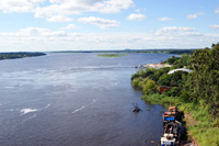 |
Paraguay RiverThe Paraguay River is the fifth largest river in South America. It is a major source of seasonal flooding, due to different flow rates between the source in Brazil and its mouth. The river’s drainage basin is often very hot and humid, featuring arid winters and wet summers.The Pantanal, a large seasonal swamp, is located on the river’s upper basin. The area surrounding the river is economically underdeveloped, and those that live along it engage in livestock-raising or subsistence agriculture. Steamers frequently use the river as a mode of transportation. |
| Back to Map | |
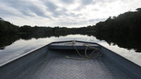 |
Guaporè RiverThe Guaporè River forms part of the border between Bolivia and Brazil. In all, it extends for about 600 miles. The river runs through a tropical rainforest in which Indian and mestizo settlements reside; its clear water makes it easily distinguishable from nearby rivers. The area surrounding the Guaporè River was the site of 18th century conflicts between the Spanish and Portugese, as well as battles between the Europeans and native tribes. In the eighteenth century, a fort called Forte Principe de Beira was built where the Guaporè empties into the Mamore River on the Brazil side of the river. The fort was one of two built by the Portuguese in inner Brazil in an attempt to protect the region from the expanding Spanish empire. |
| Back to Map | |
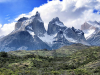 |
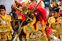
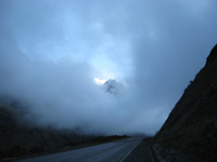
AndesThe Andes make up the world’s longest continental mountain range. The range stretches 4,300 miles in length, 430 miles in width, with an average height of about 13,000 feet. The Andes extend through Venezuela, Colombia, Ecuador, Peru, Bolivia, Chile, and Argentina. The mountains are separated into three divisions based on their climate: the Tropical Andes, the Dry Andes, and the Wet Andes. The Andes are part of the American Cordillera, a chain of mountain ranges that make an almost continuous line of mountains that form the western “backbone” of North, Central, South America and Antarctica. |
| Back to Map | |
 |
|
| La Paz | |
| Population: | 11,428,245 |
| Area: | 424,164 sq. miles |
| Capital City: | Sucre (constitutional); La Paz (seat of government) |
| Largest City: | Santa Cruz de la Sierra |
| Currency: | Boliviano |
| Official Language: | Spanish and 36 indigenous languages |
| GDP (Gross Domestic Product) | $89 Billion |
|
|
 |
|
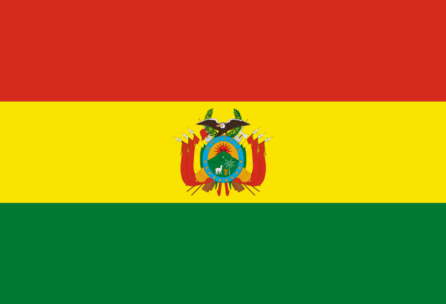
| The red on Bolivia’s flag represents the blood shed by the country’s heroes to keep it safe and preserve its republic. The green represents the country’s fertility and landscape, and the yellow represents the mineral deposits and natural resources present. The national coat of arms appears in the center of the yellow stripe. The national flag was adopted in 1851. | |