 |
Tirane (Tirana)
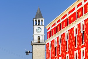
Tirana, the capital city of Albania, is a vibrant and evolving city nestled between the Dajti Mountain and the central plains of the country. With a rich history, cultural diversity, and a growing urban landscape, Tirana is an intriguing destination that offers a mix of old-world charm and modern developments.
One of the most notable aspects of Tirana is its transformation over the past few decades. After the fall of communism in 1991, the city underwent significant changes, embracing new architectural styles, infrastructure improvements, and a shift toward a more open and vibrant society. Today, Tirana showcases a blend of traditional and contemporary elements that reflect its dynamic character.
Exploring Tirana's city center, visitors will encounter Skanderbeg Square, the heart of the city named after the national hero, Gjergj Kastrioti Skanderbeg. The square is a bustling hub with a mix of historical buildings, government offices, shops, cafes, and restaurants. The square's centerpiece is the equestrian statue of Skanderbeg, a symbol of Albania's struggle for independence.
Tirana's diverse architectural landscape is also a highlight. While remnants of the city's Ottoman past can be seen in structures like the Et'hem Bey Mosque and the Clock Tower, modern landmarks such as the Pyramid of Tirana and the Albanian Parliament Building represent the city's contemporary vision.
The city is known for its lively arts and culture scene. The National History Museum, the National Art Gallery, and the Bunk'Art Museum provide glimpses into Albania's history, art, and cultural heritage. The city also hosts various festivals, including the Tirana International Film Festival, showcasing international and local cinematic talent.
Tirana's culinary scene offers a delightful array of traditional Albanian dishes and international cuisines. From cozy traditional restaurants serving flavorful dishes like byrek (savory pastry) and tavë kosi (baked lamb with yogurt) to trendy eateries and cafes, there is something to suit every taste.
The city's parks and green spaces offer a respite from the urban bustle. The Grand Park of Tirana, with its tree-lined paths, tranquil lakes, and recreational facilities, provides a perfect escape for locals and visitors alike. The nearby Dajti Mountain offers stunning views of the city, and its cable car ride is a popular attraction.
|
| |
Back to Map
|
 |
Durres
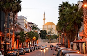
Durres is the second largest city in Albania and one of the most important ports on the Adriatic Sea. One of the standout features of Durres is its historical significance. Founded in the 7th century BC, it served as an important port city in the Roman Empire and later as a Byzantine stronghold. The city's history is beautifully preserved in landmarks such as the Durres Amphitheatre, one of the largest Roman amphitheatres in the Balkans, and the Byzantine Walls, which once encircled the city.
Durres is also home to the largest port in Albania, making it a bustling hub of maritime activity. The waterfront promenade, known as the Lungomare, stretches along the coast and offers picturesque views of the Adriatic Sea. It is a popular spot for leisurely walks, cycling, and enjoying the vibrant seaside atmosphere.
The city's vibrant beaches are a major draw for locals and tourists alike. The sandy shores of Durres Beach provide ample opportunities for sunbathing, swimming, and various water sports. During the summer months, the beaches come alive with beach bars, music, and a lively atmosphere.
Durres is renowned for its archaeological treasures. The Durres Archaeological Museum houses an impressive collection of artifacts that showcase the city's ancient past, including intricate mosaics, statues, and pottery. The museum offers a fascinating glimpse into the region's rich history and cultural heritage.
|
| |
Back to Map
|
 |
Elbasan
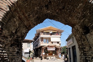
One of the highlights of Elbasan is its ancient history. The city traces its roots back to Illyrian times and has witnessed the influence of various civilizations throughout the centuries. The imposing Elbasan Castle, built during the 15th century, stands as a testament to the city's medieval past. Exploring its walls and towers provides a glimpse into the city's storied history and offers panoramic views of the surrounding landscape.
Elbasan is also renowned for its striking Ottoman-era architecture. The city features an impressive collection of mosques, including the famous King Mosque (Xhamia e Mbretit), which dates back to the 16th century. The mosque's elegant design and intricate decorative details showcase the city's Ottoman heritage and provide a tranquil atmosphere for visitors to appreciate.
The city's lively bazaar, known as "Pazari i Vjeter," is a bustling hub of activity where locals and visitors can immerse themselves in the vibrant local culture. Here, you can find an array of shops selling traditional crafts, handmade textiles, and local delicacies. Exploring the bazaar is a sensory delight, with colorful displays, aromatic spices, and the sound of lively conversations filling the air.
Elbasan is also home to the annual "Dita e Veres" (Summer Day) festival, a vibrant celebration held on March 14th. This cultural event marks the arrival of spring and features traditional music, dance performances, and a lively procession through the city streets. The festival offers a wonderful opportunity to experience Albanian folklore, customs, and traditional costumes.
|
| |
Back to Map
|
 |
Vlorë
One of the highlights of Vlorë is its historical significance. It was in Vlorë on November 28, 1912, that the Albanian Declaration of Independence was proclaimed, marking the birth of modern Albania. Visitors can explore the Independence Monument and the nearby Museum of Independence to learn about the country's struggle for independence and its rich historical heritage.
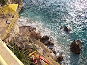
The city's coastline is a true gem, with crystal-clear waters and sandy beaches stretching along the Adriatic Sea. The main beach, known as Plazhi i Ri (New Beach), offers a lively atmosphere with numerous beach bars, cafes, and water sports activities. For those seeking a more secluded experience, nearby beaches like Radhima and Dhermi offer tranquil settings surrounded by breathtaking landscapes.
Vlorë is also home to several noteworthy landmarks. The Muradie Mosque, built in the 16th century, stands as a testament to the city's Ottoman past. Its distinctive architectural features and peaceful ambiance make it a place of tranquility and reflection. The Zvernec Monastery, located on a small island near Vlorë, is another must-visit site. This picturesque monastery is surrounded by lush greenery and offers panoramic views of the surrounding area.
|
| |
Back to Map
|
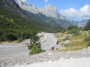 |
Korab Mountains
-
Highest Peak: The highest peak in the Korab Mountains is Mount Korab, which stands at an impressive elevation of 2,764 meters (9,068 feet). It is the highest peak in both Albania and North Macedonia, and reaching its summit is a challenging but rewarding experience for hikers and mountaineers.
-
Bordering Countries: The Korab Mountains form part of the border between Albania and North Macedonia. The rugged and picturesque landscape creates a natural boundary between the two countries.
-
Biodiversity: The Korab Mountains are home to a rich diversity of flora and fauna. The forests and meadows of the region are inhabited by various species of wildlife, including bears, wolves, lynxes, and chamois. The area is also known for its diverse bird population, making it a haven for birdwatching enthusiasts.
-
Hiking and Mountaineering: The Korab Mountains offer excellent opportunities for hiking and mountaineering. There are several hiking trails and routes that lead to the summit of Mount Korab, providing adventurers with breathtaking views and a chance to immerse themselves in the pristine alpine environment.
-
Glacial Lakes: The Korab Mountains are dotted with beautiful glacial lakes, adding to the scenic allure of the region. Lakes such as Lake Drenova and Lake Llasë offer tranquil spots for relaxation and photo opportunities.
-
Cultural Significance: The Korab Mountains hold cultural and historical significance for the local population. They are often associated with folklore and traditional stories that have been passed down through generations, adding to the mystique of the area.
-
Skiing and Winter Sports: During the winter months, the Korab Mountains become a popular destination for skiing and winter sports. The region receives a good amount of snowfall, creating ideal conditions for skiing, snowboarding, and other winter activities.
-
Protected Areas: Parts of the Korab Mountains are designated as protected areas to preserve their natural and ecological value. The region falls within the Korab-Koritnik Nature Park, which aims to conserve the unique biodiversity and promote sustainable tourism.
|
| |
Back to Map
|
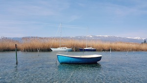 |
Drin River
-
Length and Basin: The Drin River stretches for approximately 335 kilometers (208 miles), making it one of the longest rivers in the Balkan Peninsula. It flows through Albania, Montenegro, and Kosovo, and its basin covers an area of about 19,000 square kilometers (7,340 square miles).
-
Source: The Drin River has two main sources, the Black Drin (Drini i Zi) and the White Drin (Drini i Bardhe). The Black Drin originates from Lake Ohrid in North Macedonia, while the White Drin starts from Lake Plav in Montenegro. The two rivers merge near the town of Kukes in Albania.
-
Tributaries: The Drin River has several tributaries, including the Buna, Valbona, and Lumbardhi rivers. These tributaries contribute to the overall water flow and richness of the Drin River basin.
-
Hydropower Potential: The Drin River holds significant hydropower potential. Several hydroelectric power plants have been built along its course, generating renewable energy for the region.
-
Ecosystem: The Drin River and its basin are home to diverse flora and fauna. The river supports a variety of fish species, including trout and eels. It also sustains wetland areas that serve as important habitats for numerous bird species.
-
Importance for Agriculture and Water Supply: The Drin River plays a vital role in supporting agricultural activities and providing water for irrigation in the surrounding areas. It serves as a crucial water source for communities, industries, and agricultural lands along its course.
-
Environmental Challenges: Like many rivers, the Drin River faces environmental challenges, including pollution from agricultural runoff, industrial activities, and waste disposal. These factors can have detrimental effects on the river's water quality and ecosystem.
|
| |
Back to Map
|
| |
|
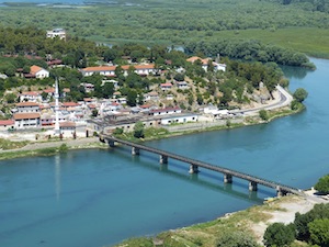 |
Mat River
-
Length and Drainage Basin: The Mat River spans approximately 115 kilometers (71 miles) in length. It has a drainage basin of about 3,400 square kilometers (1,300 square miles) and is part of the larger Adriatic Sea basin.
-
Source and Route: The Mat River originates in the Dibër Mountains, near the town of Klos. From there, it flows through the Mat Valley, passing through towns and villages such as Burrel, Milot, and Kukës, before eventually reaching the Adriatic Sea near the city of Lezhë.
-
Water Flow: The Mat River is known for its varying water flow, with the highest levels observed during the spring season due to snowmelt and rainfall. It provides a vital water source for irrigation and agriculture in the Mat Valley, contributing to the region's agricultural productivity.
-
Tributaries: The Mat River is fed by several tributaries, including the Fan River, the Shkopet River, and the Fushë-Krujë River. These tributaries join the Mat River at different points along its course, enhancing its water volume and overall significance.
-
Importance for Agriculture: The Mat River plays a crucial role in supporting agricultural activities in the Mat Valley. Its waters are utilized for irrigation, helping to sustain the region's fertile agricultural lands. The valley is known for its production of various crops, including grains, fruits, and vegetables.
-
Hydropower Potential: The Mat River has significant hydropower potential due to its flow and elevation changes along its course. Several small hydropower plants have been constructed along the river, harnessing its energy to generate electricity for local communities.
-
Natural Beauty: The Mat River passes through picturesque landscapes, including scenic valleys, rolling hills, and lush vegetation. It offers opportunities for nature enthusiasts to explore its surroundings, engage in outdoor activities, and enjoy the serene beauty of the Albanian countryside.
Back to Map |
| |
|
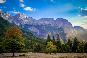 |
Accursed Mountains (Albanian Alps)
-
Geographic Location: The Caucasus Mountains form a natural barrier between Eastern Europe and Western Asia, separating the continents of Europe and Asia. The range extends for about 1,200 kilometers (750 miles) from the northwest to the southeast.
-
Highest Peaks: The Caucasus Mountains are home to some of the highest peaks in Europe. Mount Elbrus, located in the western part of the range, is the highest peak, reaching an elevation of 5,642 meters (18,510 feet) and is considered the highest point in Europe. Other notable peaks include Mount Kazbek (5,047 meters or 16,558 feet) and Mount Shkhara (5,201 meters or 17,059 feet).
-
Cultural Diversity: The Caucasus Mountains are known for their cultural diversity and rich history. The region is inhabited by numerous ethnic groups, including Georgians, Armenians, Azerbaijanis, Chechens, and many more. Each group has its distinct culture, language, and traditions, contributing to the vibrant cultural tapestry of the Caucasus.
-
Biodiversity: The Caucasus Mountains are characterized by their remarkable biodiversity. The region boasts a wide range of ecosystems, from dense forests to alpine meadows. It is home to numerous endemic plant and animal species, including the Caucasian leopard, Caucasian grouse, and various rare flora.
-
Mountaineering and Adventure Tourism: The Caucasus Mountains offer thrilling opportunities for mountaineering and adventure tourism. The challenging peaks attract climbers and mountaineers from around the world, seeking to conquer the majestic summits. The region also offers opportunities for hiking, skiing, and exploring pristine natural landscapes.
-
UNESCO World Heritage Sites: The Caucasus Mountains host several UNESCO World Heritage Sites. These include the Historical Monuments of Mtskheta in Georgia, the Historic Centre of Sheki with the Khan's Palace in Azerbaijan, and the Monastery of Geghard and the Upper Azat Valley in Armenia. These sites showcase the rich cultural and historical heritage of the region.
-
Strategic Importance: The Caucasus Mountains have long been of strategic importance due to their location at the crossroads of different civilizations and trade routes. The region has been a historical battleground for various empires and has witnessed significant geopolitical developments throughout history.
-
Mineral Resources: The Caucasus Mountains are rich in mineral resources. The region has substantial deposits of oil, natural gas, coal, and minerals such as iron, copper, and manganese. These resources have played a significant role in the economic development of the countries in the region.
Back to Map |
| |
|
|
| |
|

Moscow |
| |
|
| Population: |
145,000,000 |
| Area: |
6,600,000 sq. miles (largest in the world and nearly 11 percent of Earth's total land area). |
| Capital City: |
Moscow |
| Largest City: |
Moscow |
| Currency: |
Russian Ruble |
| Official Language: |
Russian |
| GDP (Gross Domestic Product) |
$32 billion (102) |
| |
|
| Back to Map |
|
Ten Interesting Facts About Albania
|
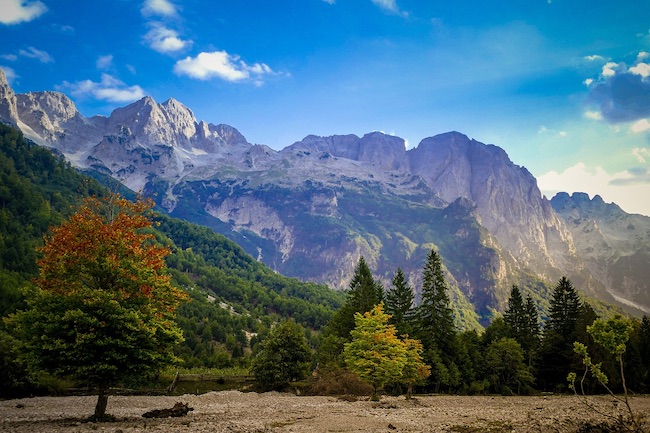
Accursed Mountains (Albanian Alps)
|
-
Ancient History: Albania is home to some of the oldest civilizations in Europe, with traces of human presence dating back to the Paleolithic era.
-
Bunkers Everywhere: During the rule of Enver Hoxha, Albania's communist leader from 1944 to 1985, the country built an extensive network of over 170,000 concrete bunkers, earning it the nickname "the land of bunkers."
-
UNESCO World Heritage Sites: Albania boasts three UNESCO World Heritage Sites, including the ancient city of Butrint, the historic center of Berat, and the Gjirokastër Castle.
-
Stunning Coastline: Albania is blessed with a breathtaking coastline along the Adriatic and Ionian Seas, featuring pristine beaches, turquoise waters, and hidden coves. The Albanian Riviera is gaining recognition as a popular tourist destination.
-
Hospitality and Besa: Albanians are renowned for their hospitality and the concept of "Besa," which is a code of honor and trustworthiness. It emphasizes loyalty, solidarity, and offering help to others.
-
Unique Language: The Albanian language is one of the oldest and most distinctive languages in Europe, with its roots in the Illyrian language. It is also one of the few languages with no close linguistic relatives.
-
Religious Diversity: Albania is a predominantly Muslim country, but it embraces religious diversity. It is home to various religious communities, including Muslims, Christians (Orthodox and Catholic), and Bektashis.
-
Ottoman Influence: Albania was under Ottoman rule for about four centuries, and its culture, architecture, and cuisine bear traces of this influence.
-
Breathtaking Landscapes: Albania is blessed with diverse and picturesque landscapes, including the Albanian Alps in the north, stunning lakes such as Lake Ohrid and Lake Prespa, and the rugged Accursed Mountains.
-
Unique Traditions and Cuisine: Albanian culture is rich in unique traditions, folk dances, and music. Albanian cuisine features a mix of Mediterranean and Balkan flavors, with dishes like "byrek" (savory pastry), "fergese" (meat and cheese casserole), and "tave kosi" (yogurt-based dish) being popular.
Back to Map
|
| |
|
| |
|
| |
The national flag of Albania consists of a simple design featuring a double-headed eagle in black, centered on a red background. The eagle is depicted with its wings outstretched and is a powerful emblem of national identity and pride. The flag's dimensions are in a ratio of 5:7, with the red color symbolizing bravery, strength, and valor, while the black eagle represents sovereignty and independence.
The origins of the Albanian flag can be traced back to the early 20th century, during the country's struggle for independence. The design is believed to have been inspired by the historical flag of the Kastrioti family, a prominent Albanian noble lineage associated with Skanderbeg, a national hero and key figure in Albania's fight against Ottoman rule. Skanderbeg's crest, featuring a black double-headed eagle on a red background, serves as the foundation for the modern flag.
The flag's colors hold great significance in Albanian history and culture. Red has long been associated with Albanian national identity and is believed to represent the bloodshed and sacrifices made by the people in their struggle for independence. Black symbolizes the resilience and strength of the Albanian nation in the face of adversity.
The double-headed eagle is a powerful symbol in Albanian folklore and tradition. It represents the unity of the north and south, as well as the strength and courage of the Albanian people. The eagle's two heads signify vigilance and the ability to look both to the past and the future. The emblem is also associated with the concept of freedom and independence, reflecting the aspirations of the Albanian people.
The current design of the flag was officially adopted on April 7, 1992, following the collapse of communism in Albania. It replaced the previous communist flag, which featured a red background with a five-pointed golden star in the top left corner. The adoption of the new flag signaled a fresh chapter in Albania's history, embracing democratic values and a renewed sense of national identity.
Back to Map |
|


