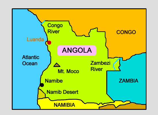
Click on the map below to learn more
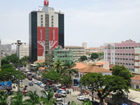 |
Luanda, AngolaLuanda is the largest city and capital of Angola. It is the largest Portuguese speaking capital city in the world, and the third largest Portuguese speaking city in the world. Nearly 1/3 of all Angolans (nearly 5,000,000) live in or around Luanda; 53% of which live in poverty. Luanda is currently under major reconstruction and is actually one of the most expensive cities in the world for foreigners to visit. |
| Back to Map | |
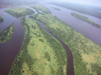 |
Congo RiverThe massive Congo River is the world's deepest river, with a maximum depth of 720 feet. At 2,920 miles in length, the Congo River (combined with the Chambeshi River) is the 9th longest river in the world and the 2nd longest in Africa. The Congo River flows through ten Africa nations before emptying into the Atlantic Ocean. Much of the river weaves through the Congo rainforest, the world's second largest rainforest.
|
| Back to Map | |
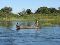 |
Zambezi RiverAt 1,599 miles in length, the Zambezi is the fourth largest river in Africa, and the largest that flows into the Indian Ocean from Africa. Hippopotamuses can often be observed in the Zambezi River. Lions, cheetahs, zebras and giraffes can also be seen along its shores. The most famous feature of the river is probably Victoria Falls, on the border of Zimbabwe and Zambia, which is considered the largest waterfall in the world. |
| Back to Map | |
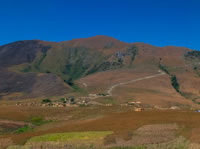 |
Mt. MocoAt 8,600 feet in height, Mt. Moco is the highest peak in Angola. |
| Back to Map | |
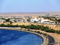 |
NamibeNamibe is a port city on the southwest coast of Angola. It has a dry, desert climate as the northern limit of the Namib desert stretches into Angola and includes Namibe. Prior to 1985, Namibe was called Mocamedes. Its population is apx. 87,000. |
| Back to Map | |
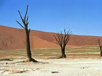 |
Namib DesertThe Namib Desert a coastal desert in southeastern Africa and one of the world's most desolate places. The name "Namib" means "vast place." Few, if any, people live within the desert. The northern coast of Namibia is sometimes called the Skeleton Coast because of the high number of shipwrecks caused by intense fog formed by the interactions of wet, ocean air with the dry desert air. Most of the desert lies along the coast of Namibia, with a small portion in southern Angola and northwestern South Africa. Stretching over 31,000 sq miles, the Namib desert is about the size of the state of Pennsylvania. This region typically gets less than 10 millimeters of precipitation a year, but the western portion of the desert gets only 5 millimeters of rain per year. A few plants species, which can survive off of desert fog, live within the Namib Desert. |
| Back to Map | |
| Population: | 24,383,301 (2014) |
| Area: | 481,354 sq. miles |
| Capital City: | Luanda |
| Largest City: | Luanda |
| Currency: | Kwanza |
| Official Language: | Portuguese |
| GDP (Gross Domestic Product) | $139.059 Billion (64th) |
|
|
 |
|
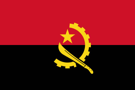
| The flag of Angola came into use following the nation's independence from Portugal in 1975. The red in the flag is said to represent the "blood-split" of the Angolan people in their quest for independence, while the black represents the continent of Africa. The symbol in the middle of the flag shows a half-gear, which represents the nation's workers and industry and a machete with a gold star, which represents agriculture and the nation's armed struggle for independence. | |